Category: Uncategorized

Four men and a hike (Day 1) – Tenaya Lake to Sunrise Creek Camp.

Four men and a hike (Day 1) – Tenaya Lake to Sunrise Creek Camp.

img_5352
Clouds Rest to the left

Prologue: Prologue: This is a detailed write-up of a backpacking trip from September 11 to September 16, 2016. I’m sharing it for a couple of reasons: to give a heads-up to anyone thinking about tackling this loop and to highlight some mistakes we made along the way. If this helps someone avoid our errors, then I’ve done my job.

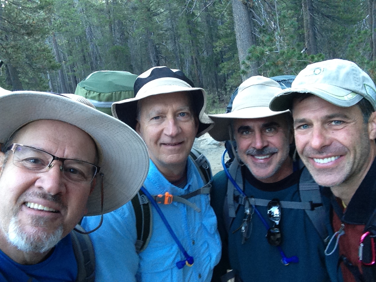
We ventured into the stunning Yosemite backcountry on this trip, blessed with near-perfect early fall conditions. Unexpected challenges forced us to adapt our route on the fly. I’ve divided this account into six parts, each detailing a day’s events, hoping you’ll find the story engaging. Joining me, were my hiking partner Jeff H., Jeff’s brother Kevin H. from Ohio, and my cousin John H. from Houston, TX. Jeff and I handled most of the trip’s logistical planning.

Arrival:

IMG_5376.JPG
Will, John, Jeff & Kevin

Our planned route was ambitious for us, older hikers who undertake major treks only once or twice a year. Jeff and I, both seasoned adventurers, regularly enjoy overnight backpacking trips in the coastal mountains of Los Padres National Forest. The Sierra offers a different experience, where meticulous planning and preparation are essential for an unforgettable journey. In these mountains, knowing your limits every bit as important as the wilderness experience. Kevin has some experience backpacking in Glacier National Park but would admit to not being a regular backpacker. For John, this was his first backpacking trip in the Sierra. We all committed months to rigorous fitness preparation to meet the physical demands of the trip.

In the planning of this trek, the High Sierra loop caught our eye. While we could not hike the complete trail, we instead developed into the plan a route incorporating two of the iconic geological structures, Half Dome and Clouds Rest. The plan began to coalesced around a loop that egressed at Sunrise Trailhead near Tenaya Lake and terminated at Toulumne Meadows. I mapped the route using the 7.5′ topo map feature in Caltopo. I use the “line” feature to route over the dotted lines that represented the trail on the map and used the “marker” at each mile. Knowing mileage helps in gauging distance, potential campsites and factoring in the distances we wish to hike each day. I will go into the caltopo features in a stand along post later.

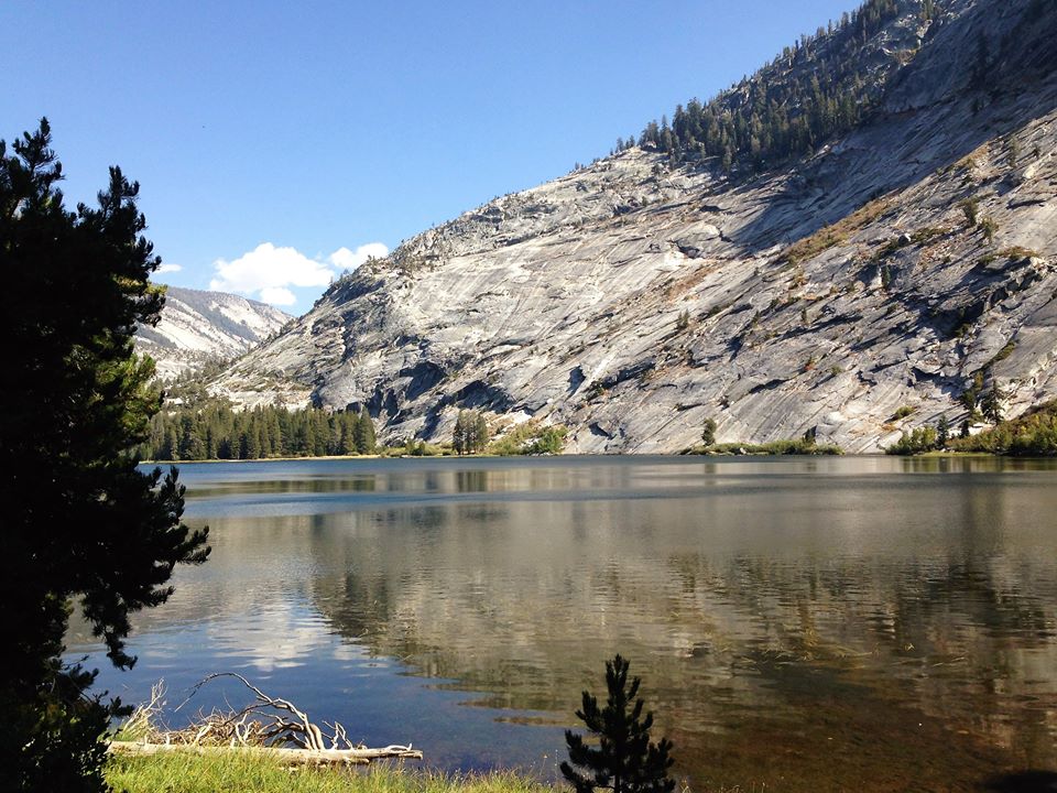
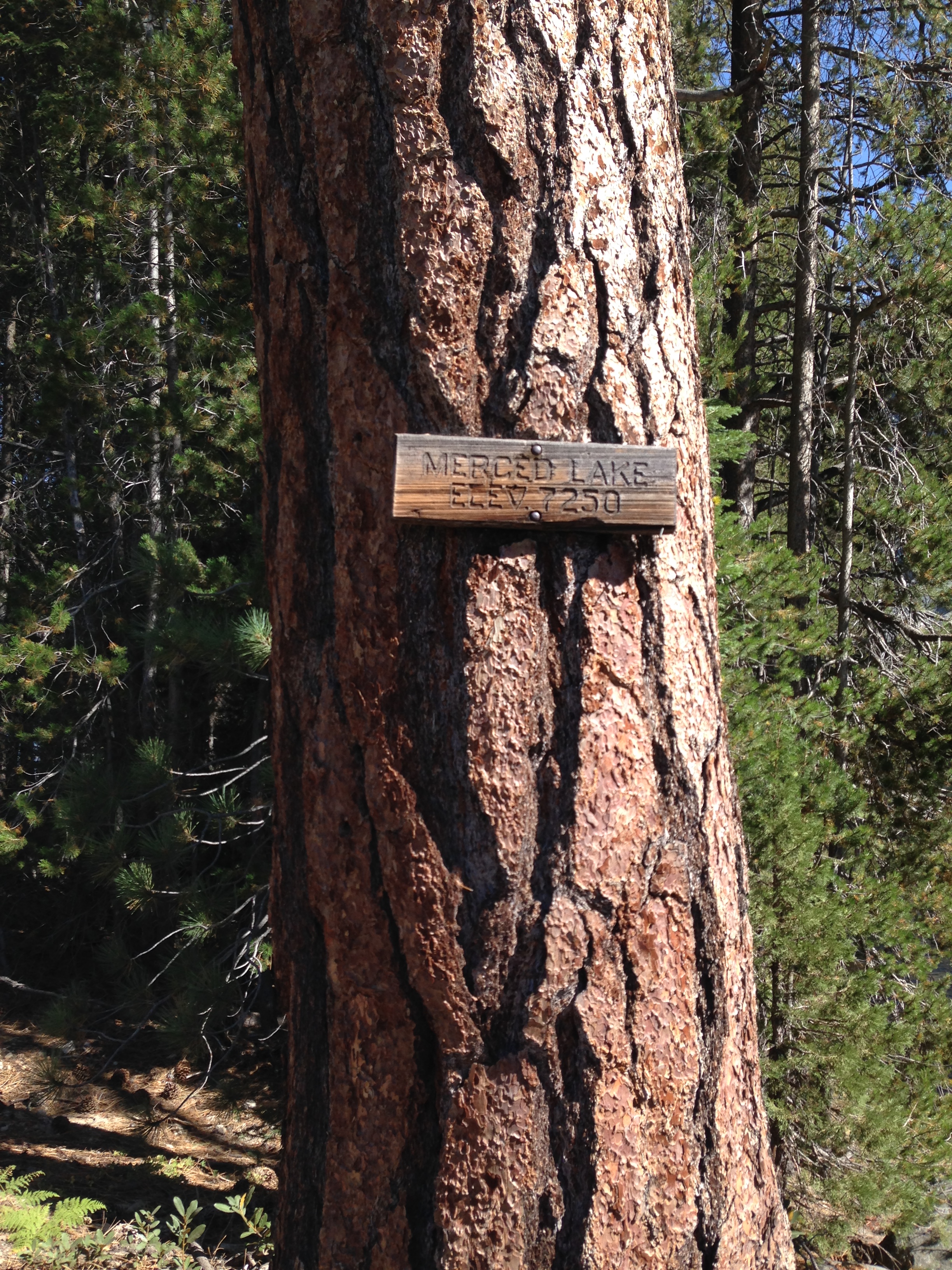
The final route was cemented into place by Jeff and I in early August. We would start by arriving a day early so we could acclimate to the altitude. We opted to stay at Tuolumne backpackers campground on Saturday evening before our Sunday start (Sept 11, 2016). The team decided to start the trek at Sunrise Trailhead at Tenaya Lake because we all wanted to “bag” Clouds Rest, a granite arete that is situated east of Half Dome in Yosemite National Park. Our ambitious first day would take us 7.2 miles to the summit of Clouds Rest where we would be treated to a “look-down” view of Half Dome and the surrounding terrain. Once over Clouds Rest, we would descend another 2.7 miles to Sunrise Creek camp situated at the Clouds Rest /John Muir Trail junction. The following day would greet us with a 3 mile hike to the famed cables and the dramatic views on top of Half Dome. We would return to Sunrise Creek camp, break-down camp, pack-up, and head out through Little Yosemite Valley to camp at Merced Falls. Day three would incorporate a hike from Merced Falls through both Echo Valley and Lost Valley. We would be following the Merced River through a narrow canyon up to beautiful Merced Lake where we would camp for that evening. Day four would be our most strenuous of the hike. We would leave Merced Lake, elevate quickly up along Lewis Creek trail traversing over 8 miles to another impressive climb to 11,516′ over Vogelsang pass. We would then descend into the Vogelsang Lake area to camp. Rising early on Day five, our wanderings would take us on to Vogelsang High Sierra camp, catching a junction that would take us past Evelyn lake toward Ireland lake. Our intentions would be to stop at the Ireland Lake Junction and day-hike the out and back to Ireland Lake. We would then finish the day by trekking southeast down the trail into Lyell Canyon and a forecasted camping spot at the JMT junction. To wrap up the trip, Day 6 would be a long but relatively easy slight downhill on the JMT back into Tuolumne Meadows, effectively cinching the loop. All told, the proposed route was nearly 50 miles. Included in the route were major climbs at Clouds Rest, Half Dome, the climb out of Merced Lake toward Vogelsang pass and Vogelsang pass itself. 

The Start:

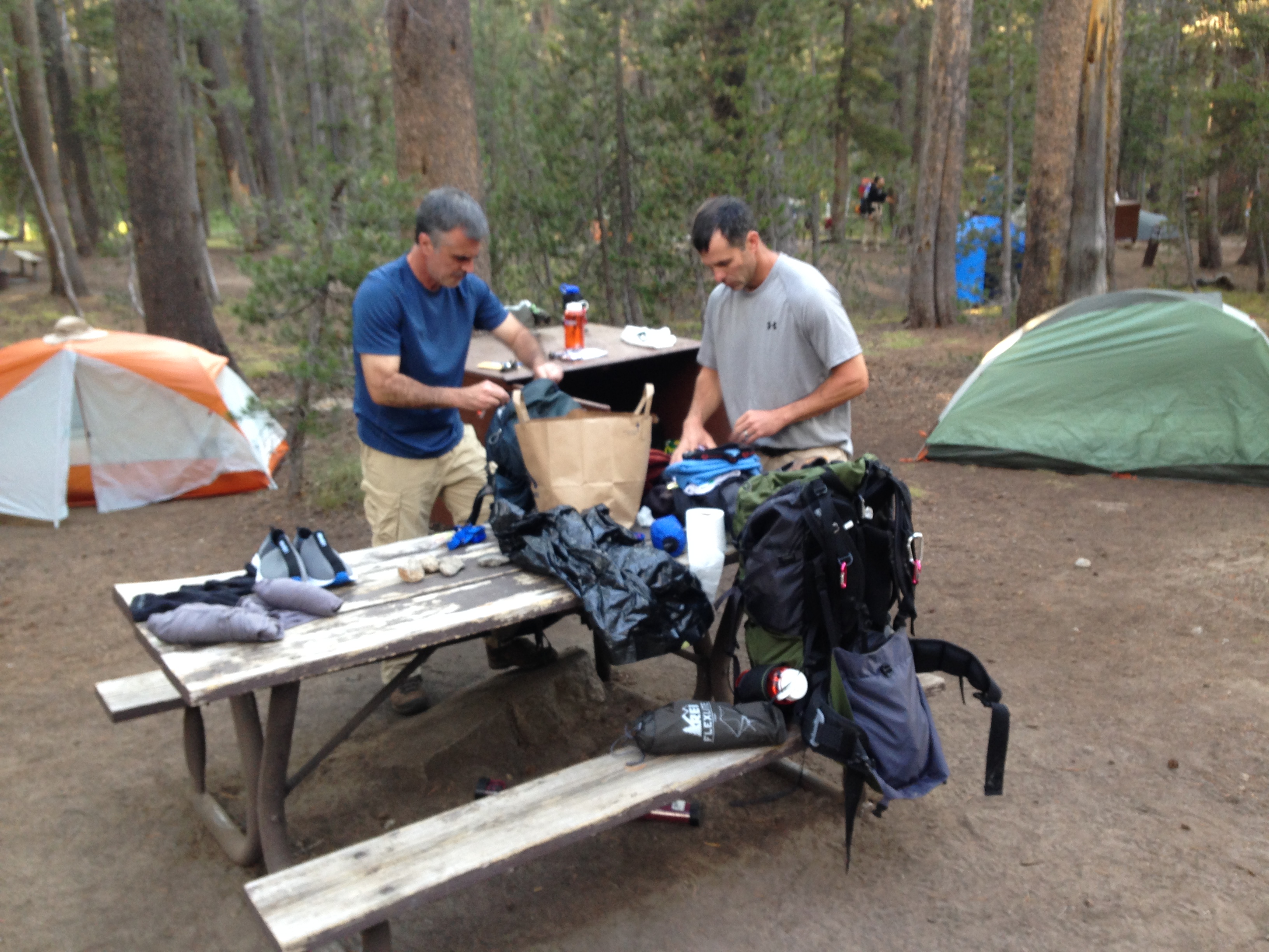
Saturday, September 10th:  Today was the culmination of a copious amount of planning and coordination heralded by our arrival at Tuolumne Meadows Wilderness Center. After securing our requisite permit and rules lecture from the Ranger we drove over to Glen Aulin Road and parked the car. We unloaded our gear and headed over to Tuolumne Grill for a tasty burger, knowing that the next six days would consist of snacks and dehydrated mountain house meals. Spirits were high among the group and truth be told, were anxious to get rolling down the trail. But that would have to wait until morning. To be honest, I always prefer a day to acclimate to the altitude especially since we drove up from sea level. After eating, we walked the short distance to Tuolumne backpackers campground to secure a campsite and set up our tents. Sites appeared to be filling up fast. Luckily, we found a great site right off the main trail. Some yellow hazard tape across the bear box must have scared off other potential campers as it appeared to have a broken lock. Jeff put his mechanical skills to work and soon had the temperamental bear box key working fine. Once camp was set up we made fire in the fire ring, talking and getting to know each other in more detail. A few nips of our favorite spirit soon loosened the lips and good conversation and jokes were flying around. Kevin had come in from Ohio, taking some time off from his business and family. John came in from the flat lands of Houston Texas. He had prepared and trained hiking trails around his hometown. To mimic the climbs, he loaded up his backpack, hiking up and down the stairs of the 33 story office building where he worked. Jeff and I are long time friends and had started hiking together as a way to “get back into shape”.  We both have experience hiking in the Sierra and teamed up to planned this trip. Evening came, and camp quieted and and a early start lay ahead of us so with great anticipation we retired to our tents.

IMG_5364.JPG
Jeff & Kevin packing up at backpackers camp Tuolumne Meadows

5am! “Rise and shine, the birds are singing and the sun is shining and it’s a brand new day in the world,” as my father used to say. We needed to be at the Tuolumne Grill shuttle stop for our 7 mile ride over to Tenaya Lake and Sunrise Trailhead. It was still dark and by the time we made our way to the grill, the yet-to-rise sun was beginning to lightened the Yosemite sky. Like clockwork, the shuttle arrived and grabbing our gear from the nearby table, we boarded. We were the only people on the shuttle and the driver clairvoyantly asked, “Sunrise Trailhead”?  We confirmed her premonition and were soon driving west down Tioga road for the 12 minute trip to Sunrise. Everybody was quiet, surely going over personal checklists in their mind, double-checking they had not forgotten anything. Placid Tenaya lake showed up on our left. Driving past I glance up at Tenaya peak looming over the lake. I’ve driven by this spot over the years and often wondered to myself “what’s on the other side of that peak” and today I would start to find out. With the shuttle pulling over to the side of the road my thoughts returned to getting on the trail.

IMG_5379.JPG
Getting situated Sunrise Trailhead (Tenaya Lake)

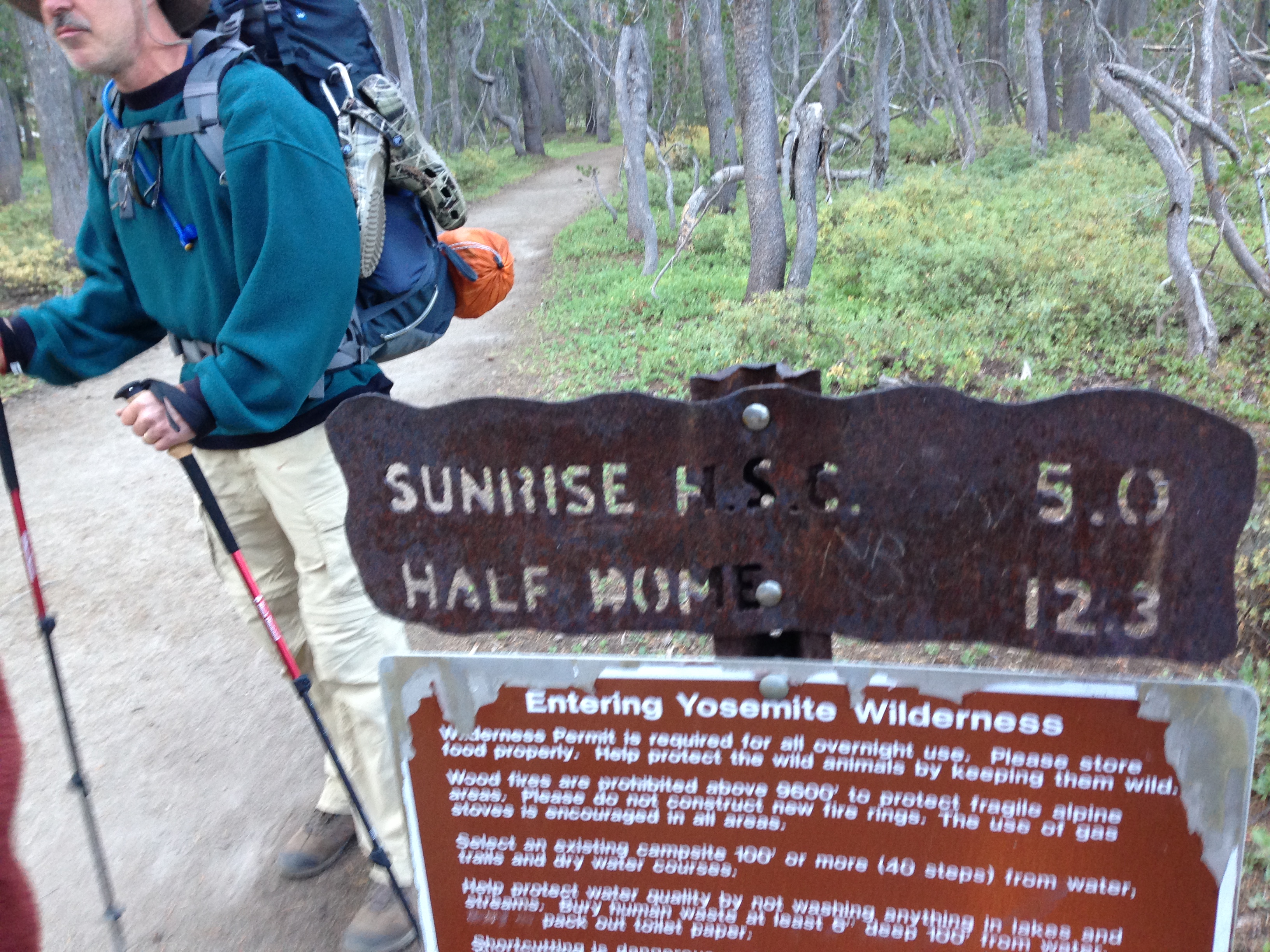
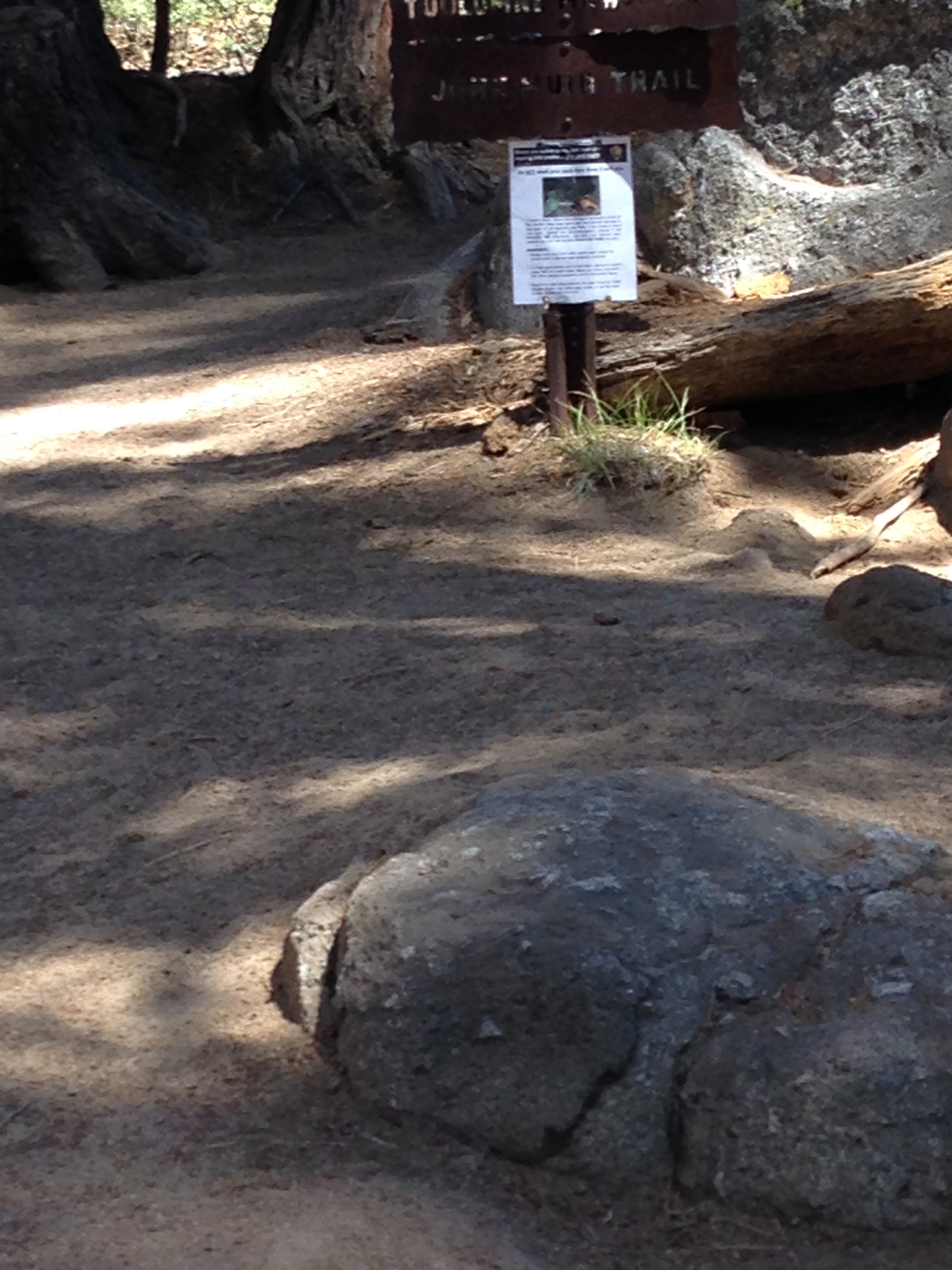
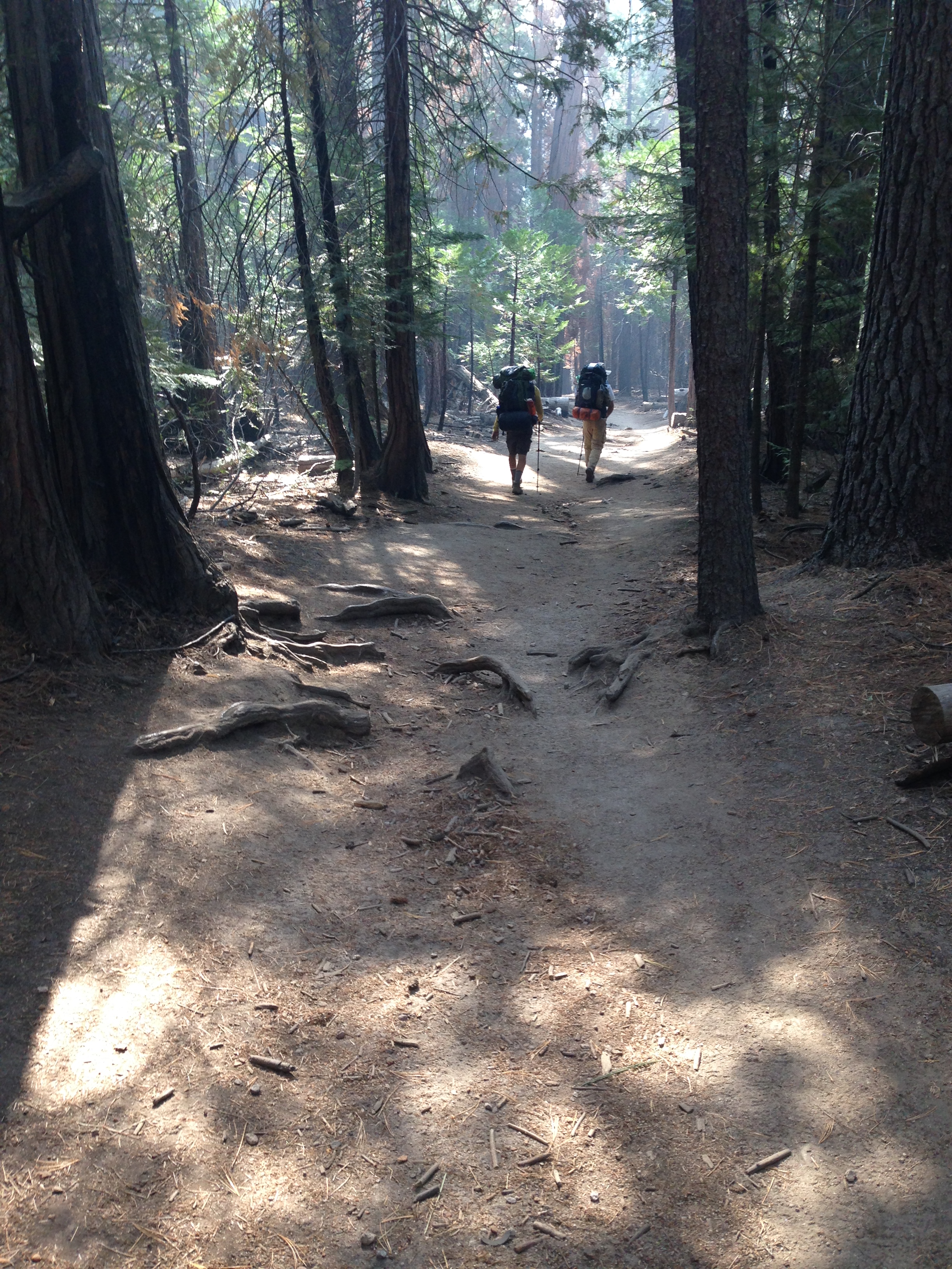
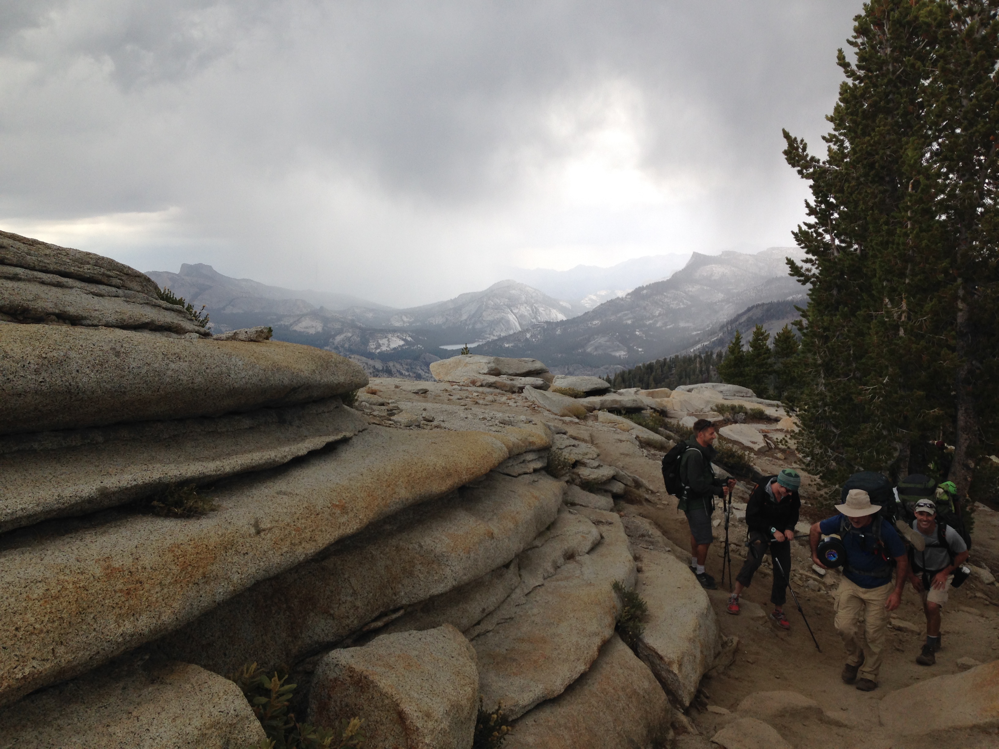
We quickly disembarked from the shuttle, wiggled into our backpacks and scrambled across Tioga road to Sunrise Trailhead. Taking some quick pictures at the trailhead, we secured our trek poles and took our first steps down the Sunrise Lakes trail. We made our way past the western end of Tenaya Lake. The first mile of the trail was wide, straight and flat. Invariably, whenever starting a long trek, I habitually do a quick physical assessment. My left knee usually shouts at me with sharp arthritic pains, letting me know it’s not to happy to be carrying the 35 lbs of weight. My shoulders are usually pulling back, feeling the load and my hip belt is asking for constant tightening to secure the pack and carry the load over my hips. The first mile of any hike is always a settling in process. My breathing is usually labored as my body works to adjust to the load, exertion and altitude. Constant adjustments continue until you fall into rhythm and pace that your body agrees with. So it was during the first mile on the forested trail and presently we ascended slightly into a vigorous climb up the rocky, root straddled trail. Periodically, we caught glimpses through the trees of the granite landscape toward Olmstead point. These sneak peaks afforded an opportunity to catch our breath and to look back toward Tenaya Lake and our point of origin. The climb steepened and we pushed up a series of switchbacks eventually cresting a ridge line at the Sunrise Lakes trail junction. At one point during our early planning, Jeff and I had entertained the idea trying to secure a walk-in permit and hiking to the lakes for our first night, but time and logistics worked against us, so we stayed at Toulomne campground to acclimate instead.

Clouds Rest was still four miles away and from the Sunrise Lakes junction the trail descended down into a wide canyon with sunrise mountain south of us. Our southerly progression now turned slightly westward through an undulating series of ups and downs that wound through trees, tiny open spaces, an occasional small vernal pond and bushy meadows. Clouds Rest imposing prominence could be seen ahead and announcing the climb that was sure to come.

IMG_5384.JPG
Sunrise trail looking back toward Tenaya Lake
IMG_5392.JPG
A quiet pond on way to Clouds Rest

The unexpected:

One of the basic tenets of backpacking is to expect the unexpected. We were about at the 3.5 mile mark of the days hike when we experienced the unexpected. As John stepped over a tree root that crossed the trail, his left foot landed on the edge of trail concavity. The awkward placement of his foot, the shifting of his body, the fully loaded backpack, coupled with a glance at the surrounding views, all conspired to caused him to rolled his ankle and fall. We rushed to his aid and as John collected himself, he muttered “It’s my ankle, I rolled it pretty good”.  Jeff encouraged John to take his time as we helped unbuckle his pack and get if off him. It was at this point where our collective thoughts started to process our predicament. A year of planning – three and a half miles into a week long trek and we had a injury and a lot of uncertainty as to our next course of action. John took off his shoe and looked at his ankle – no swelling…yet. First indications were that the sprain may not be serious. John stood on it and took a few steps. He walked a few yards up and back on the trail to see how it felt. He winced but said he thought it would be okay. At some point I asked if he felt he could continue. He responded that he could. It was decision time and a choice had to be made. Either turn around, hike back and regroup at Sunrise trail head or continue on up and over Clouds Rest to our eventual camp at Sunrise Creek. At this point, I’m sure John was thinking that he did not want to be the guy who had to bomb-out on this trek. He was toughing it out. After taking a couple over-the-counter pain medications and with his positive affirmation, we continued on. We were working under the assumption that John had dodge a severe sprain. We helped him get his gear back on and resumed our hike.

In the meantime, I was watching the eastern sky closely. In the distance I could see clouds building up toward Tuolumne. I knew from research and reading that its not uncommon for afternoon thunder storms to build up and blow in over Yosemite. At this point, I could not tell if a storm was in the offing, but it warranted watching. Back on the trail, John was struggling and his pace slowing. We were into the meat of the Clouds Rest climb, so around mile five we stopped to reassess. It was becoming obvious that John’s sprain was worse than hoped and he was struggling to push-off with any strength. At some point a good Samaritan saw John languishing and offered him an ice-pack for his ankle which he gladly took, stuffing it into his sock. Even more frustrating, though we all had fairly extensive first aid kits, none of us had brought an ankle-wrap bandage. We did have duct tape and suggested to John that we could wrap his ankle using his sock as a buffer to the skin but John said he wanted to continue without. To speed up the pace we decided to try to lighten John’s load. I took the loaded top cover which coverts to a hip belt off his Osprey backpack and attached it to my pack. Jeff volunteered to carried John’s fully loaded bear canister weighing at least ten pounds in his arms. This meant Jeff used no trek poles for the climb up to Clouds Rest. Kevin carried John’s tent and some other weighty items in his already heavy pack.

img_5397
A panorama of the approaching eastern storm

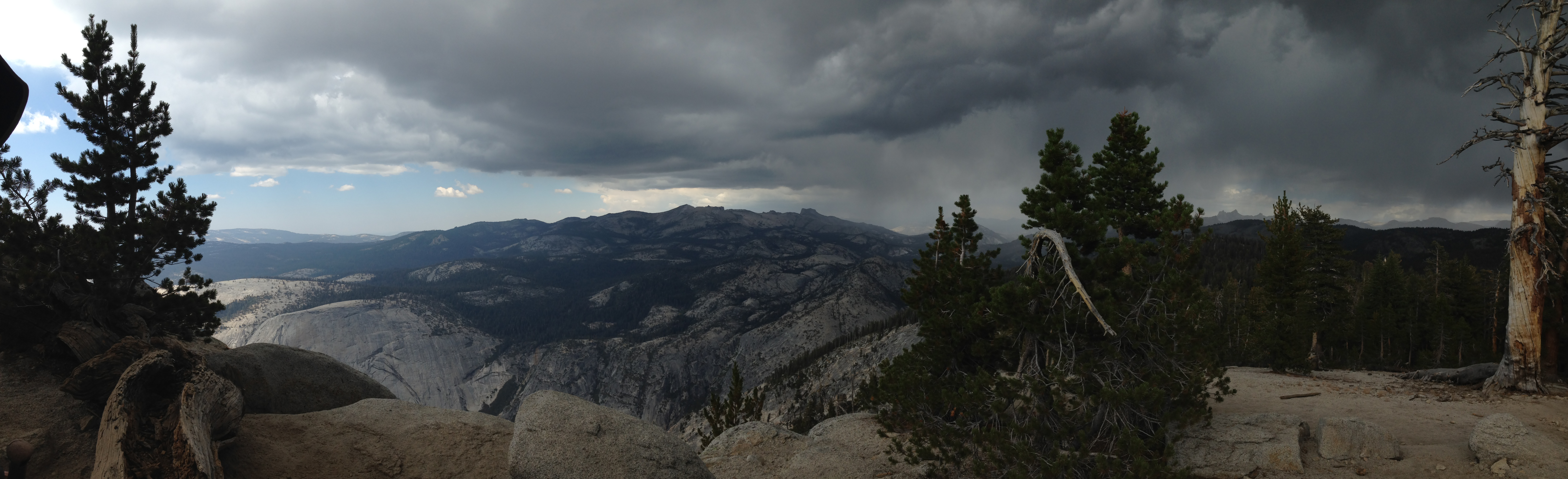
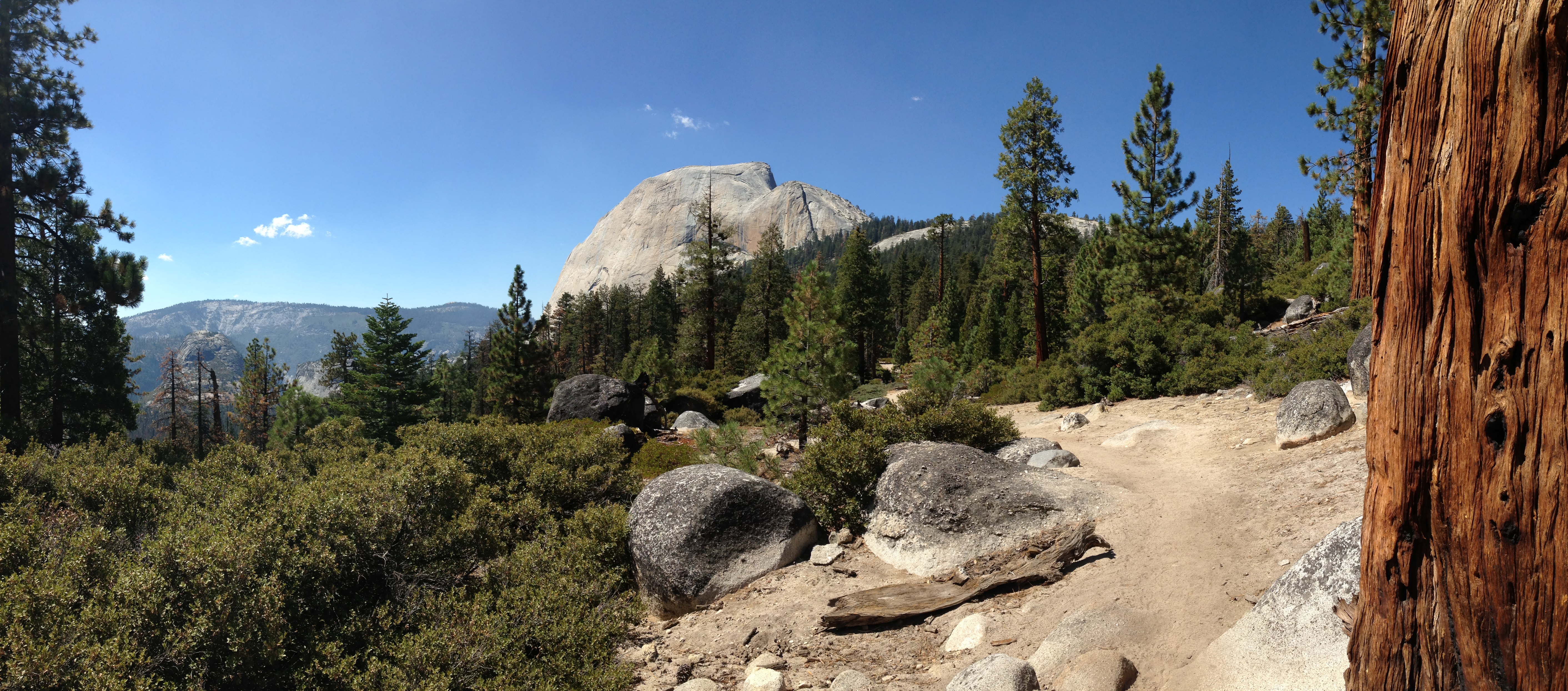
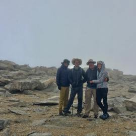
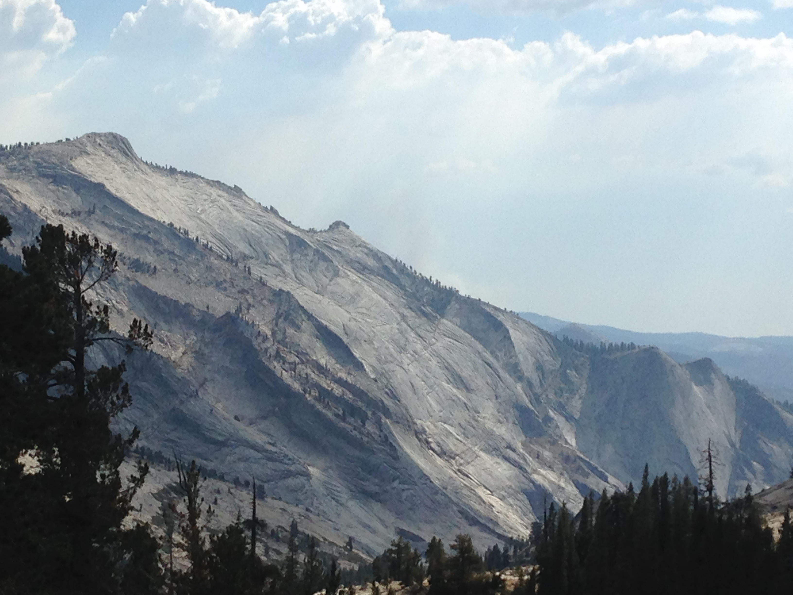
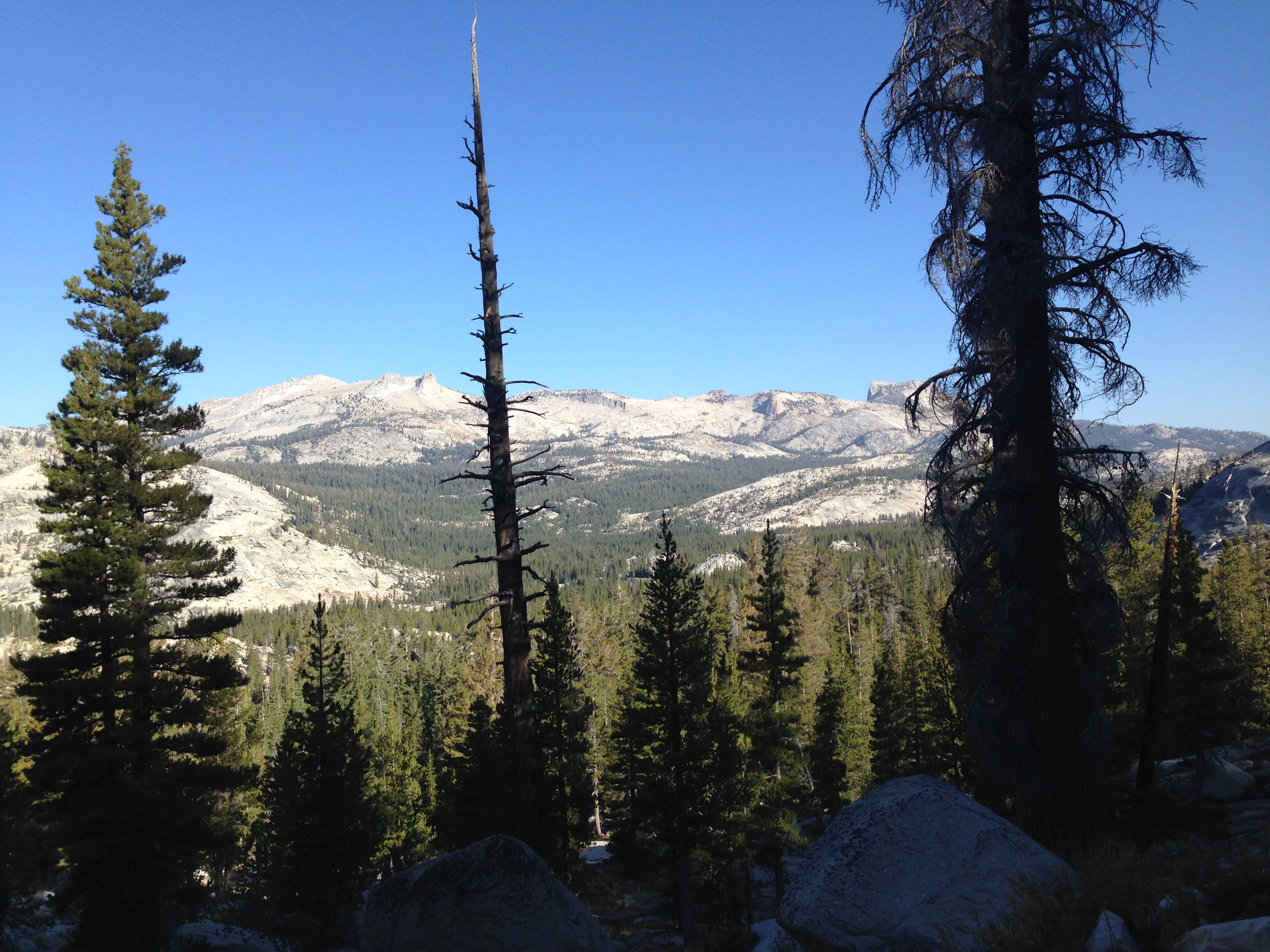
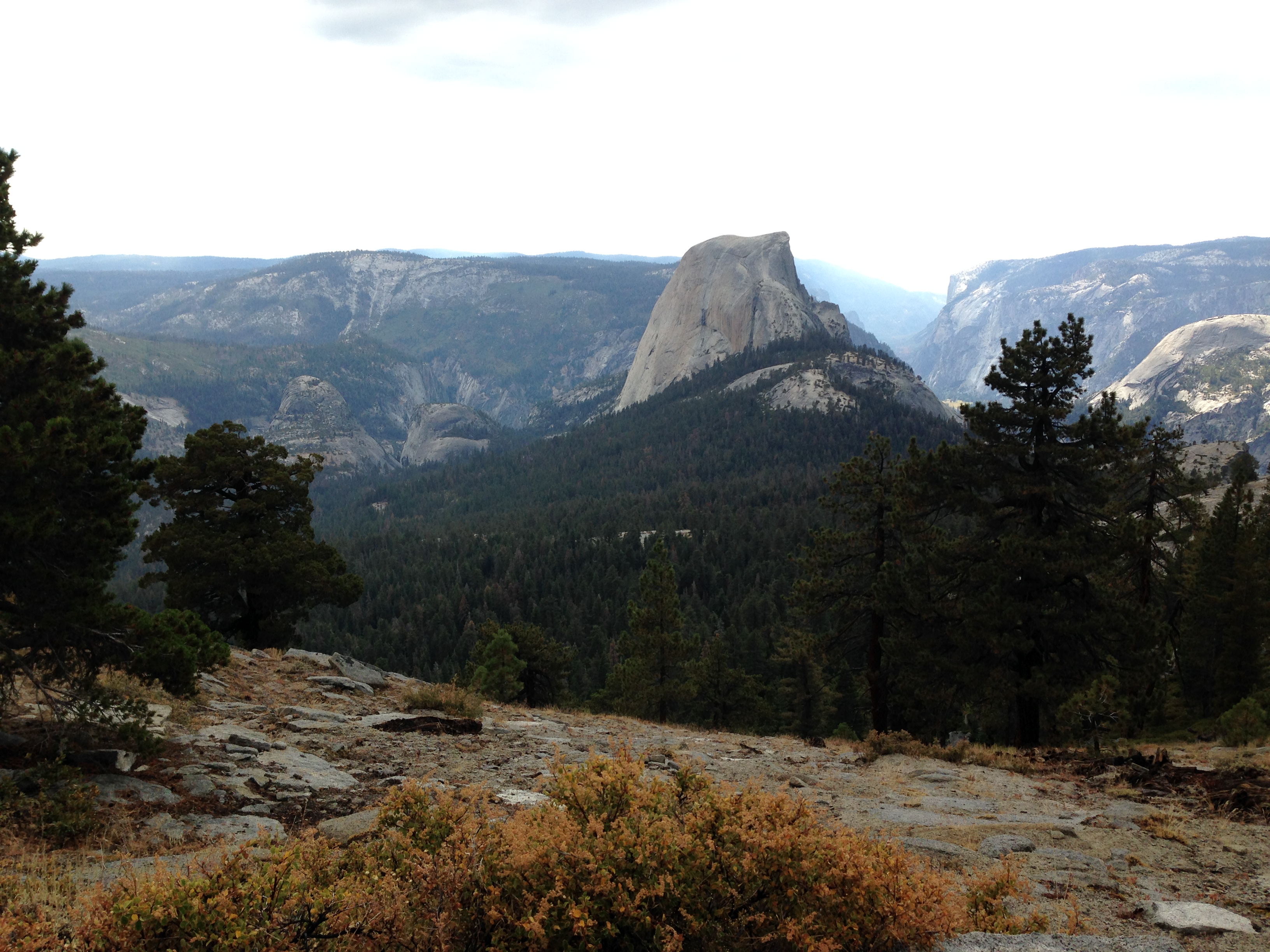
With a lighter load, John’s speed improved and he was pushing through the pain. But the additional weight, and awkward loads were taking a toll on us and the group stopped frequently to rest. We arrived at sign that indicated that we were 1.2 miles from the summit of Clouds Rest. We decided to rest and eat some lunch. We could see on our topo maps that the climb was about to get steeper. We had lost time and had fallen behind schedule and it became clear that the gathering storm was coming our way. The once distant rumbles of thunder were sounding closer and sheets of rain could be seen falling over the mountains to the southeast on its approach toward us. Eating quickly, we pushed on trying to beat the storm to the summit. As we closed in on the summit of Clouds Rest, day-hikers were scurrying down. It was getting windy and sprinkles were starting to fall, even as we remained in  bright sunlight. John and I had gotten ahead of Jeff and Kevin arriving at the summit together. The last 100 yards to the top of the summit of Clouds Rest is a bit of a boulder scramble. Exhausted, John and I crested the east side of Clouds Rest. The summit of Clouds Rest resembles stacked granite slabs that taper to a narrow ridge which stretches about 600′ from east to west. As we moved across the summit, the obvious trail across the ridge narrowed to a thin strip of uneven granite, with precipitous drop-offs of glacially worn granite on either side. With the wind gusting and sprinkles turning to drops, we made our way gingerly across this narrow stretch. Without taking my eyes off the trail, I could see in my peripheral vision the 3000′ drop into Tenaya Canyon on my right. Glancing left I could see the 2000′ foot drop where the unseen the John Muir trail paralleled our position below. I whispered a quick prayer for protection from lightning or any other worrisome danger and made my way across this narrow isthmus to the point where the path widened to a safer flat section. My enthusiasm at making it to the top of Clouds Rest was short-lived and tempered by the storm that was upon us. It had been a hard climb, and a cardinal rule in Yosemite is to never be on top of a high granite place during a thunderstorms. Yet here we were, doing something I have criticized others for doing. Jeff and Kevin had just crested the eastern summit about 200′ away from us. The view of the oncoming storm from the direction of Sunrise lakes was incredible. The clouds were low in the sky and the falling rain faded out the background mountains. Looking west, we could peek into Yosemite Valley and directly adjacent loomed mighty Half dome, at a slightly lower position. On Half Dome, we could clearly see the sub dome and just beyond the polished granite path where the cables guide hikers to her summit. To the north we viewed the deep drop into Tenaya canyon and in the distance Olmsted point. To the south, the back country surrounding Little Yosemite valley, and in the far distance the Ansel Adams wilderness. It was simply spectacular!

img_5403
The “stacked” granite appearance on the summit of Clouds Rest. Note Jeff carrying John’s bear canister and Kevin’s huge pack
img_5425

Jeff and Kevin cresting the east side of Clouds Rest. Note the rain fading out the background.

img_5439
Half Dome seen from Clouds Rest. Yosemite Valley behind half dome.
img_5422
Panorama of Half Dome and Yosemite Valley

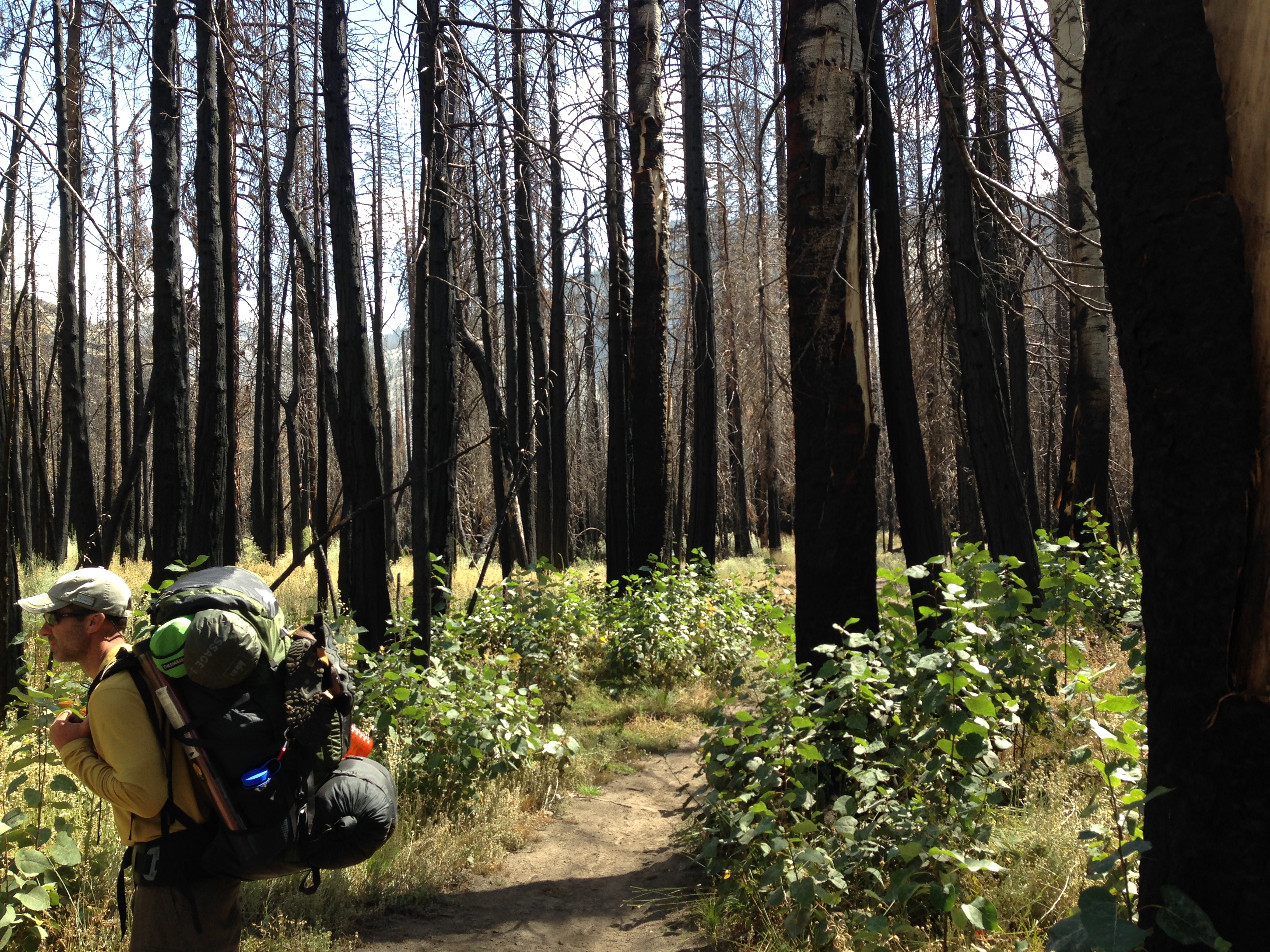
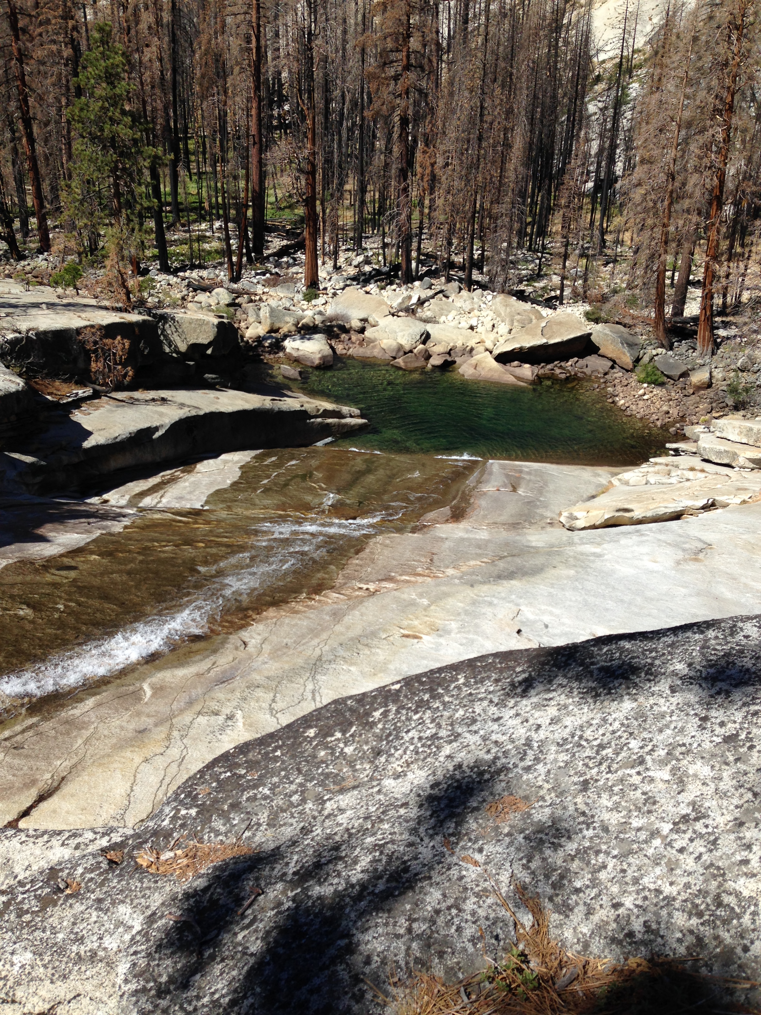
With clouds directly over us now, the concentrated center of the storm was still to the east but its proximity to Clouds Rest still presented a danger. John and I took in the view and snapped some pictures. Knowing we had pushed our luck, I said to John, “we need to get off this rock” and proceeded make our way to the western side of the summit. We found the trail descending down the west side of Clouds Rest. John gingerly started down the 3 mile descending trail toward the JMT junction. The immediate descent from the summit on the westside is scary steep and John, with a his hurting ankle, made slow but careful progress down. In the meantime, as I gestured to Jeff & Kevin to come over, a loud rumble of thunder echoed up the nearby canyons and a little to close comfort. I signaled to them I was going down. Doing my best NOT to rush, I carefully stepped my way through the steep decline and soon joined up with John. Not long after, I could see Kevin and Jeff moving down the steep western trail from the top of Clouds Rest. Knowing they were moving our direction, John and I went ahead of them toward Sunrise camp. The hike down from CR to the JMT/Sunrise is a series of long switchbacks that look south over the Yosemite back-country. Rain was soon falling with enough volume to warrant putting on our rain shells and applying our backpack rain covers. Looking south into the Yosemite back country from this vantage point brought into view a vast expanse of domes, distant peaks, valleys, and canyons.  I could clearly see Moraine dome and an unnamed dome near our future camp site at Merced Falls. Looking south-west, Mt. Starr King could be seen in the distance past Little Yosemite valley.

IMG_5442.JPG
Yosemite back-country looking south from Clouds Rest trail

The long, switch-backing trail from CR to Sunrise was well-traveled and in good shape and during this descent, I ran through various scenarios regarding John’s situation. First my goal was to get to sunrise camp and access our situation and regroup. With that goal in mind I moved ahead of John and was first to the JMT/ Sunrise camp Junction. Arriving a sunrise camp I sat down on a rock, contemplated the predicament. I was pretty sure John’s hike was done. There simply appeared no way John would finish the remaining 5 day trek with the distance and climbs that were planned. My mind raced with thoughts. Was this the short finish to our long-planned trip? Would Kevin & Jeff have to continue alone? Or, could we formulate an extraction plan to safely get John out and possibly salvage the trip? As I sat there, worn out from the days events,  I check my cell phone and surprisingly discovered I had cell service. It was at that point a plan started to hatch in my mind. Day two would prove to be interesting as you will read in the next section.

Post script: So at this point and speaking for myself, I will sheepishly admit to some iffy decision-making on our part. We let the excitement and anticipation of a long-planned trip potentially get in the way of safety. First, when John injured himself we were only 3.5 miles from our start, Sunrise trailhead. We could have simply hiked out and regrouped at Sunrise.  No one wants to be “that guy” who is responsible for throwing a wrench into long-made plans. As our scenario unfolded, that factor edged us toward decisions stay on trail. Secondly, the decision to go back should have been a no-brainer with the approaching storm, yet we went on. Third, not having a ankle wrap (ace bandage) in our first aid kit was a big miss – inexcusable really.  In retrospect, I think we all agree that it was a series of questionable decisions, one leading to the next, that led us to keep pushing to keep this trek alive. We took some risks, got lucky, and made it through. We walk away a little smarter and better prepared for next time. 

Four Men & a Hike (Evening Day 1 & Day 2) – Sunrise Creek Camp Layover (unplanned).

Four Men & a Hike (Evening Day 1 & Day 2) – Sunrise Creek Camp Layover (unplanned).

Day 2 (Monday September 12, 2016):  Sunrise camp at the Clouds Rest / John Muir trail junction is a well used camping area for backpackers heading out on the John Muir trail. Our camp was located here, adjacent to the JMT. Sunrise Creek nearby provides a good source for water for filtering.

(Evening day 1): In camp at the end of day one, it was clear that John’s trip was done. John’s ankle was swollen, black and blue. He had courageously struggled over Clouds Rest to get to camp. To attempt five more days of backpacking in the Yosemite back country that included uphill miles, a rough, rocky trail and a high mountain pass wasn’t destined to happen. Not that John wasn’t willing, but even he acknowledged that he could do more damage to his ankle.

That night at camp, our group talked over our circumstances. At present, the completion of the whole trip rested on our ability to somehow extricate John. John was adamant that he did not want the rest of us to quit the trip on account of his injury. He insisted that he would exit alone so we could continue on. None of us were comfortable with him walking out by himself. John is my cousin and was my guest. I felt it my obligation to escort John out safely so I volunteered. I would need to carrying his backpack to keep pressure & weight off his ankle. This led to discussions of ways to safely get John out AND salvage the trip for the rest of us.

I want to also mention at this point that in our original permitting process, we had received permits to do the Half-Dome cables. That part of the trip was slated for tomorrow. The original plan was to day-hike from Sunrise camp to the HD junction and up to the cables onto the top of Half-Dome. Once completed, we would hike back to Sunrise camp, lunch, break camp, hike on to Little Yosemite Valley and head out east along the Merced River to Merced Falls.

IMG_5448.JPG
Clouds Rest and John Muir trail junction at Sunrise camp.

Sunrise Creek Camp is situated about 7.5 miles away from Happy Isles in Yosemite Valley. Having agreed to walking John out, the discussion turned to what that involved. Working in our favor was the hike out was mostly downhill from Sunrise into little Yosemite Valley. The subsequent two miles to Nevada Falls would be flat, and the final 3.6 miles downhill to Happy Isles. Total mileage from Sunrise camp to Happy isle was about 7.5 miles one way. To be able to keep our trip alive would require me to hike a total of 16 miles. The thought of a 16 mile round-trip to HI and back to Sunrise camp and then another 4 miles to Merced Falls would be daunting. Simply put, my backpacking trek would be over as well.

IMG_5450.JPG
img_5458

However, another option began to take shape that offered a trip-saving solution. We surmised that I could walk John the 3.5 miles to to Nevada Falls and have someone meet us there to aid John the rest of the way out. In turn, I could reverse and hike back to Sunrise, thus doing only 7 miles instead of the 16 miles. Just when it seemed that the trip would have to be called, a viable option saved the day.

As I mentioned earlier, I discovered we had cell phone service from Sunrise camp. A series of calls to my wife allowed us to come up with an exit plan for John. It went like this. My wife made contact with my sister and brother-in-Law who, as fortune would have it, live in Copperopolis CA, 1.5 hours from Yosemite. My brother-in-law Gary, volunteered to drive up to Yosemite Valley to pick up John at Happy Isles. From there, they would get John to a doctor for treatment & recuperate at their home.

Since I had previously done Half-dome I would forgo tomorrows hike to Half Dome. Instead, I would carry John’s backpack and escort him down the JMT, through little Yosemite Valley to Nevada Falls. He would carry my day-pack, filled with minimal water and some food for my return trip to Sunrise Camp. From Nevada Falls, John would continue the rest of the 3.5 miles down the John Muir trail to Happy Isles. In the meantime, Jeff  & Kevin would go ahead and hike up Half-dome as planned. It would be Kevin’s first time. We agreed we would all meet back at Sunrise later that afternoon. We all agreed to this plan and set about coordinating the details. 

img_5445
John hiking out to Happy Isle’s and ending his trip early due to a badly sprained ankle. showing fortitude and determination, John somehow managed to hike the 6 miles up to the summit of Clouds Rest and down to Sunrise Camp after injuring the ankle. The next day I hiked with him out to Yosemite Valley.

On Monday morning we executed the plan flawlessly. John and I hiked out to Nevada Falls where we switch packs and said our regretful goodbye’s. I was sad that John’s trip was ending this way and I know he was disappointed. John is a fighter and not one to walk away from a challenge. Nevertheless, It was the right decision. Not long after heading down the John Muir trail from Nevada Falls, John was met by my brother-in-law Gary who had walked up the trail from Happy Isles. Gary carried John’s pack the remaining miles to the car. John was safely returned to civilization and medical care. Meanwhile, I put on my day pack and reversed course, hiking back up to sunrise camp. It was a relief knowing John was in good hands. I arrived back at Sunrise camp and took a snooze. Several hours later, Jeff and Kevin returned from half-dome and we shared stories of our respective days events. Kevin’s was excited at his first experience on top of Half Dome. Kevin was not exactly comfortable with heights and the pull up the cables of half dome was daunting. But once on top, the sense of accomplishment and awe overrode the fear. He and Jeff exulted in the thrill of being on top of this impressive wonder of nature. Back at camp, we were all exhausted from the days events and the amount of morning hiking already done. Tired and famished from the days trek, Jeff suggested we stay one more night at Sunrise camp get some needed rest. We agreed and would head out early the next morning for the next leg of our trek. This decision would also mean altering our route somewhere along the way to make up for the lost day. That story comes later, but in the meantime that night proved to be one of the better nights of sleep I have ever had on trail.

(Footnote: After meeting my Brother-In-Law Gary at Happy Isle’s, John and Gary headed out of Yosemite and back to Copperopolis, CA and to a doctor office. The doctor confirmed John’s ankle was badly sprained (no break). By this time, John’s ankle was swollen, black and blue. Our post hike recap confirmed we made the right decision to get John to medical help instead of pressing on. A few days later, John drove back to the coast (of California) to my home and flew back home to Texas. The following year, John came back to hike the High Sierra Trail with us – this trip went without incident and we had a great time.)

Four Men & a Hike (Day 3) – Sunrise Creek Camp to Merced Falls.

The trail to Merced Falls

We awoke at Sunrise Camp with a sense of renewal and an energized outlook that our trek into the Yosemite back-country was back on track. We had slept in a little this morning and a few early-goers were already on trail. These early-risers strode passed our tents, dangling camp gear clinking with each step as they made way up the John Muir Trail or on to Clouds Rest. We broke camp and hit the trail around 9am heading down toward the Half-Dome/ JMT Junction. Our goal today was Merced Falls and this hike would be the shortest of our trek encompassing only about six and a half miles. Merced Falls is situated at the easternmost end of little Yosemite Valley, in the Merced River water shed. The mile and a half hike to the Half Dome junction offers splendid views of both the sub-dome and Half Dome. One can clearly see the cables on Half Dome and the early hikers working their way up the face of the dominating monolith. Looking south, one is treated to a spectacular view of the back country domes; Moraine dome is nearby, in the distance Mt. Starr King rises. Further out, in a southerly direction, distant domes, peaks and mountains mark the Clark range. On this day wisps of smoke from an unknown fire were wafting in from that southerly direction filling Little Yosemite Valley with layered, smoky haze and soon visibility and air quality became poor. I felt some empathy for those people climbing half dome as the magnificent views were sure to be affected by the hazy smoke.

Once past the HD junction the human traffic on trail increased as the morning groups made their way up out of Little Yosemite Valley up toward HD. Within the tree line smoke interspersed with shafts of morning sunlight streaking through the pines and made for a surreal mid-morning glow. We soon emerged from the tree line onto Little Yosemite Valley’s flatter ground and made our way south past the ranger station trail toward the Merced River. Using our pre-routed GPS maps on our cell phone, we navigated through the camp ground area to the Lake Merced trail.  A quick turn on a corner and we were heading east, paralleling the Merced River and heading east toward Merced Falls.

img_5467
Smoke mingles with streaks of sunlight as we hike from Sunrise to Little Yosemite Valley

img_5477
Kevin in the old Meadow fire burn scar as we head toward Merced Falls.

The hike from Little Yosemite Valley to Merced falls is flat, skirting the granite on the south side of Moraine Dome. The well-marked trail thorough this area was flat consisting of aggravatingly soft sandy river sand. Walking with weight-laden legs through this sand forces one to change their gait from stride to short, purposely placed steps, lacking little heal to toe push-off. One finds themself constantly looking for more solid tread on the periphery of the sandy sections of trail in effort to ease the strain on one to ease the effort on their calves. Making our way through the narrowing eastern end of Little Yosemite Valley, we came upon the remnants of the 2014 Meadow fire. Blackened, leafless, twiggy skeletons of trees stood in silent testimony to the destruction of the fire. But the resiliency of mother nature showed its life force of regeneration with broad-leaf greenery and yellow Coreopsis and Goldenrod sprinkled across the forest floor. The trees, bereft of pine needles, revealed views of the Cascade cliffs and Bunnell Point that rose up on the south side of the Merced River. 

At the eastern-most edge of Little Yosemite Valley, the southern wall of Moraine Dome pinches in to meet the north facing granite walls of Cascade cliffs, to form a narrow pass. It’s here that in the spring, that Merced Falls is fed by ice melt that flies over a steep granite escarpment with roaring volumes of water. But we are here in early September and typical of recent years in California, in drought conditions. Merced falls was flowing with a narrow but vigorous rush of water that emptied into a large, crystal clear pool. It was not hard to envision the spring volume of water being exponentially heavier and the thundering of the falls reverberating off the surrounding granite walls. Initially, we walked past Merced Falls not realizing we have arrived. We moved up the trail, seeking a flat, non-burned area to camp, but it became evident that the fire had burned up through this area and the narrowness of the canyon did not offer any reasonably flat ground. We decided to backtrack to a previously observed flat ground and the base of Merced Falls. Our camp site sat upon a mixture of river sand and pebbles hinting to the fact that prior to drought conditions this area was underwater. It proved to be a great spot, allowing easy access to the pool and our first opportunity to try some fishing.

img_5504
Unnamed dome (#7683 caltopo) looms over our Merced Falls Campsite and Jeff H & his brother Kevin.

We quickly set up camp with a fisherman’s eye on the crystalline pool at the falls. With our tackle in hand, Kevin and I boulder-scrambled to the granite escarpment where the falls coursed down into the pool. My first cast into the riffles behind the white water yielded a strong bite and I reeled in a smallish Brookie. It was beautifully spotted and colored and I gently released him back to the water. Almost immediately Kevin yelled “fish on” and his bent pole indicated that he had a good size fish on the line. Kevin’s catch was a foot long brook trout as well – a beautiful fish indeed. The fun continued with hit after hit of small to medium trout hooked, reeled in and released back to the cold waters. Even Jeff got into the act catching small trout. The setting sun, the glow on the nearby dome, the rush of water on rock nearby and the good fishing made for a Muir-like idyllic setting that I will remember for years to come.

img_5492
Merced Falls late in the summer season – We fished in the pool from the granite escarpement – the Brook trout cooperated giving us some good fight and fun.
img_5496
Kevin Fishing the pool at the base of Merced Falls.

The pool, with its inviting clarity and cold waters was too much to pass up on a warm day. Stripping down to natures look, I waded into the cold waters and clean off the sweat and grime from the days effort. Lying on the tilting granite, I let the sun dry my body. This pause in activity afforded the opportunity to take in the sounds of the falls and the enveloping beauty of the towering domes. For me, it’s these moments of peace and solitude that I cherish when in the wilderness. This mind-emptying seclusion is what I relive when I’m back in civilization. I never miss a chance to enjoy it and never take it for granted. Back at camp, Kevin capped “happy hour”  evening “toast” and a treat of sardines-in-mustard served with cheese and crackers. All I can say is that it was absolutely delicious and something I will do again. As the campfire dwindled, our camp banter subsided into individual thoughts and soon we were thinking about tomorrows hike to Merced Lake. It was feeling like a backpacking trip should.

Four Men & a Hike (Day 4) – Merced Falls to Merced Lake.

img_5510

Bidding adieu to Merced falls, took our first steps of day four and headed up the trail continuing east toward Lost Valley. An epic day of hiking awaited us and we worked our way through the Merced watershed. A short day of relatively easy hiking lay ahead to reach Merced Lake. A slight climb out of Merced Falls on a north easterly tack skirts the base of an unnamed dome before you enter into Lost Valley. Lost Valley soon appeared and we pursued a steady trail through a forested area nestled amid the high granite walls of Bunnell Point to the south and the steep granite edifices east of Moraine Dome that framed the north side of the valley. The meadow fire had burned into Lost Valley, and a plethora of new growth covered the forest floor. From the valley floor, the walls ascends steeply, slowly rolling back, away from the distant hiker. The sparsely covered granite gives way to a pine covered apex, lipped edges and ground cover firmly rooted in cracks and crevices. We were treated to a cascading stream that fell from the lip of this ridge, its waters hitting outcroppings on the descent, splashing and deflecting down to the valley floor to eventually merge with the Merced River.

A mile into the hike we came upon Bunnell cascade. During the spring, this impressive gap forces the waters of the Merced into a narrow crevice dropping with force and determination to another beautiful emerald-colored pool. However, this late in the year, the cascade is tame and the flow of water a mere trickle. The steepness of the cascade can be measured by the climb one has to make to ascend along this bottleneck of granite. We stopped to explore around this area taking in the falling waters, the burnt forest and imposing walls of the surrounding granite.

img_5522
A low volume of flowing water at Bunnell Cascade

Onward we trudged now in an easterly direction, a slight uphill climb through the squeeze of the Bunnell Cascade gap. Coming down the trail, we met a family of deer approaching cautiously. A young buck was in the lead followed by a doe and her fawn. We stopped, silently taking in graceful friends. The animals stopped as well, stoically measuring us for threat and danger. The deer continued toward us, now with confidence in their walk. It appeared they aim to pass right by us on the trail, but within a few yards of our position the buck turns left leaving the trail tacking across the granite slope. As they circumnavigate our position, we were thrilled to witness, quiet observers in nature’s theater.

14333064_1273183182692479_2150523596429222522_n
The deer encounter on the trail

The gradual climb out of the cascade continued for a half a mile interspersed with small meadows and granite escarpments. When hiking a new trail, each turn is a new treat. We know the hidden gems we discover today in mid summer will appear different in winter or spring. It’s this ever-changing dynamic of weather and conditions in Yosemite that acts as a lure for backpackers to come back to see it in a different light. We soon crossed a footbridge that leads us to the south side of the river and turning east again, we launched into an 800′ climb over the next mile. A series of challenging switchbacks pulls you evermore upward and eastward. On these southern cliffs that navigate over impassable areas of the Merced river, we are treated to deepening views into the narrow gorge through which the Merced river crashed. The trail becomes a combination of purposely placed cobbles and with granite steps, periodically place to elevate the natural inclination of rocky slope. Tired legs, labor over these pesky steps, to burning thigh muscles and deep exhalations from tired lungs. These cobbled trails were clearly designed with pack trains in mind, and we witness a mule train on its return trip from Merced lake navigating down the trail, leaving fresh, odorous evidence of their passage. The hike reaches its apex as the tread flattened out and we hiked across open areas of granite that tendered us vistas of the canyon we just navigated through. Looking back, the views to Merced Falls & little Yosemite Valley – Looking ahead – the distant views of high peaks and promises of further climbs.

14355549_1273183296025801_483385775038994823_n
Example of the granite cobbles on the trail heading east out of Bunnell Cascade
14333720_1273183309359133_2729258154864566995_n
At the apex of the climb our out of Bunnell Cascasde, the view ahead suggested high peaks and promises of steeper climbs.

Where the cobbles end, the trail tops out, meandering across smooth granite lined with small boulders to mark the trail. We came across early evidence of fall in a small grove of yellowing aspens whose quaking leaves were dropping upon the trail. Now descending, we again met up with the Merced River and transited another footbridge that carried us to the north shore of the Merced and the trail into Echo Valley. Echo Valley is flat and dry and the confluence of two creeks. Miles to the north, Echo Creeks journey began near the Cathedral range flowing south and spilling over the south-facing cliffs into the Merced watershed to merge with the Merced River. Conversely, miles to the south Clark Canyon Creek is born in the steep reaches of Mount Clark and Quartzite Peak, Flowing north and descending over the north facing cliffs above Echo Valley to Merge with the Merced. Appearing on maps to be wide and vigorous creeks, both were bone-dry, a testament to the continuous drought and late summer conditions in California. Fortunately, our water supply was adequate and we were not relying on Echo Creek to replenish.

Echo Valley also offers substantial tree shade and a needed respite from the days building heat in the bottom of this canyon. We opted to take advantage of the shade in this valley and stop for a lunch. I dug through my bear canister pulling out a foil pouch of Tuna fish, a tortilla, some cheese sticks and crackers and washing it down with water. We eat, discussing the dry conditions of the creeks and the steep ascent of the nearby Echo Valley trail head. The trail Junction, steeply heading north, directs adventurous hikers out of Echo Valley and north toward Cathedral peak area or if desired, to rejoin the John Muir Trail. After our rest, we gear up and once again are heading on our easterly route toward Merced Lake. The trail here is obvious and well worn and we find ourselves hiking through sandy scree indicative of low-lying river basin sand and its proximity to the merging rivers and creeks.

img_5549
A hint of fall in the quaking aspen

We were now within a mile of Merced Lake and the trail continues with its flat tread eastward, with slight curves around the contours of the nearby granite walls. Soon, we are getting glimpses of the welcomed site of Merced Lake and the Merced river head waters. Arriving at the lake source of the Yosemite’s Merced river was inspiring. The Merced River; the  iconic river of the Yosemite Valley, whose waters rush over both Nevada and Vernal Falls and meander through the grand valley itself is fed from the collected waters of Merced lake. Above the lake, the Merced river courses down from Washburn Lake and the Triple Peak Divide area. Waters in the Merced build in volume from emerging springs and gushing tributaries emanating from Red Peak fork, Triple Peaks fork and the Merced Fork. The Merced pours into picturesque Washburn lake first, spilling out and flowing onward to gorgeous Merced Lake. As the Merced cascades through these lakes and canyons, it nourishes along its shores wetlands lined with reeds, flowers and shrub and trees. Over the millennia, the river has carved artistic sculptures into the granite walls and boulders bringing forth its hidden beauty and grandeur. Its heady stuff to stand in awe of as surely others have done over time, to revel in the mysterious past, the hidden stories that the Merced River contributes to the whole of the Yosemite National Park.

14368881_1273183372692460_1622572461134952841_n
Our First view of Merced Lake near the Headwaters of the Merced River
img_5556
Elevation sign at Merced Lake.

We continued the final mile toward camp along the north shore of Lake Merced. A tree marker indicated the lake elevation to be 7250′. Over the course of the 6 miles we hiked today from Merced Falls, we had gained about 1000′ feet in elevation. None of us felt particularly exhausted and Kevin and I were eyeing shoreline access points revealing to us access points to the lake and fishing. Camp Merced is a “surprise” of a camp. There is a High Sierra Camp here at Merced Lake, one of five in the Yosemite park. The camp is lined with canvas covered yurts active with human activity. Outside the boundaries of the High Sierra Camp are well maintained and spacious camp areas for backpackers. A looming, redwood tree towers above a spigot capped with a drinking fountain. Running water can be gathered to utilize for cooking a nice respite from using our gravity flow water filters. Nearby there’s restroom with a flushing toilet. Three days into the hike, it felt a little like cheating to use these amenities.

We found a great campsite and erected our tents and soon headed down to the lake shore to beckon the fishing Gods for some trout action. Venturing back along the trail, I find a spot that allows me to navigate through lodge pole pines to a small beach on the shore of Lake Merced. Several casts into the clear waters yielded no action at all. I threw the line out near some visible underwater reeds and immediately felt the hit of a strong bite. Tip up and reeling vigorously, I brought in my first small brown trout. After releasing him I cast again into the same area – again I was rewarded with an even stronger bite and reeled in another beauty of a fish. This brownie was gorgeous,  yellow in hue with dark speckles and spots and every bit of 10 inches in length. I gently unhooked him and released him back to the waters, overjoyed with the fight and effort he gave. The view across the lake is compelling, with towering precipices and majestic trees all the while fishing in quiet solitude. Several more strikes occur, the fish diving for sunken logs and myself reeling the line to thwart its plan. My evening is fulfilled, I reel in my last cast, gather my tackle box and regress back to camp with satisfied dreams of Sierra fishing.

14317514_1273183409359123_6564367652934694976_n.jpg
My prize Brownie who put up a good fight – with a kiss on the brow I released it to fight another day.

Back at camp and nestled amongst the surrounding lodgepole, ponderosa, incense cedar, and white fir, darkness came quickly. We collected some deadfall, stacking the for a nice fire. Over our camps stoves we lounged in our portable camp chairs, talking in low voices as the camp quieted down. Sparkling stars dotted the clear night sky and a waxing moon shone bright through the tree tops out here in the deep recesses of Yosemite. Our musings soon led to tomorrow’s hike. It would be nearly 9 miles, with two big climbs and a continuous uphill gradient for nearly 8 miles. We agreed we should start picking an early 7:00am “on trail” time. Tomorrows goal was Vogelsang Pass. Situated at 10700′, we would gain 3500′ in elevation. At backpackers midnight we all went to our tents and retired for the evening anticipating the next days effort.


Continue reading “Four Men & a Hike (Day 4) – Merced Falls to Merced Lake.”