Author: Pancanman

Four Men & a hike (Day 5) – Merced Lake to Vogelsang Pass.

img_5569
The climb out of Merced Lake toward the Lewis Creek / Fletcher Creek trail Junction.

There are days in the wilderness that the excitement of the upcoming day wakens you, and the urge to get hiking takes hold. In the process of mapping this trip, I would look at this particular stretch of trail and say to myself, “that’s going to be a hard day”. With nervous excitement I went through my normal system of preparation inside my tent. My pre-hike training was paying off and I felt in the best hiking shape gained from diligent training and shakedown hikes. It was 6:00AM and I was awake, feeling alive and ready for the challenge.

Passing Merced Lake Ranger Station as we headed toward Lewis Creek trailhead.

During our stay in camp, a nearby hiker mentioned we were going “the hard way and against the grain” with our easterly route, stating that most opt to come downhill from of Vogelsang to Merced Lake to Yosemite Valley. For me, going clockwise set up the hike to be finish with strong scenic views in higher elevations and interesting, unfamiliar areas. Donning our backpacks, our trio took the first steps of today trek. From Merced Lake we left camp heading east, following the metal signs and our GPS map toward the Ranger station about 1/2 mile away.

A footbridge at the ranger station marks the start of the first big climb out of Merced lake. The route took us up toward Lewis Creek and immediately the trail grew steep with typical stair-stepping granite cobbles and frequent switchbacks. The climb out of Merced Lake gains 1000′ in elevation in the first mile and a half. The exertion was hard on calves and thighs now feeling the burn with the ever-increasing climb. Knowing a long day was ahead, we took periodic breaks to catch our breath. Stopping rewarded us with gorgeous views that looked back through the trees at placid Merced Lake and the Merced River watershed we’d hiked the day before.

img_5578
Looking back to Merced Lake as we ascend on day five toward Vogelsang Lakes area –  The top of Half Dome can be seen in the distance.

The steep incline lays down a little by the time you reach the trail junction for Fletcher Creek trail that heads left up to Emeric lake. But our day continued by following the trail paralleling Lewis creek in a north east direction. The trail traversed a steep, north facing incline of forested granite. Above a movement gained my attention. I spied a large buck was looking down on us. With each step, his hooves were were precisely placed, wary of us and moving in unison parallel to us. I glanced away to tell the others and when looked back, like a ghost had disappeared into the forest.

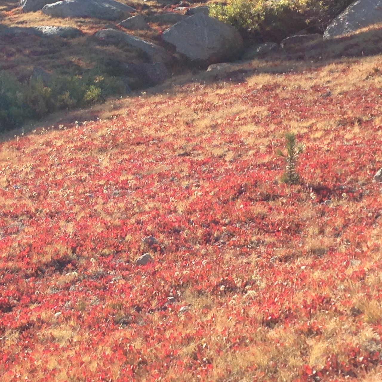
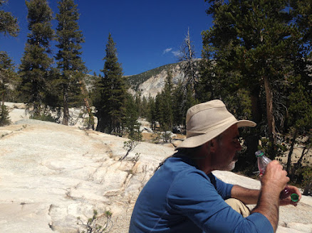
At mile three, the trail steepened again into a series of switchbacks carrying us past 8700′. The trail undulated, inch worming up and down over the next three miles, following Lewis Creek on a transverse tact and a slight up-sweep toward higher elevations. Throughout this part of the trail, granite escarpments welcomed us and purposely placed rocks to show hikers the path forward. This late in the year, we found Lewis creek running thin over these flat granite escarpments, falling and splashing over small slabs, ledges and filtering through crevices from which we filled water containers.

Jeff lunching at the Bernice Lake trail Junction

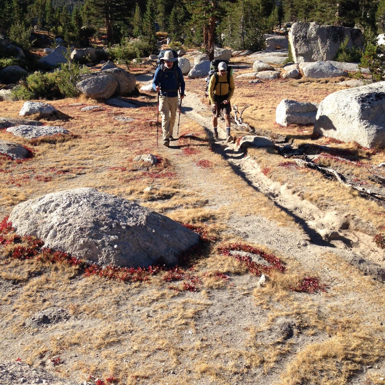
Beyond mile five we encountered another steepening slope challenging our tired legs to push on through. The words of that hiker at Merced Lake echoed in my head. Glancing at the map, we decide that Bernice Lake trail Junction, at six miles, will be our stopping point for lunch. The welcoming sight of the old rusted metal sign for Bernice lake trail appeared. Our elevation was 9800′. We took off our packs and from within retrieved our bear cannisters. Flat and inviting granite lured us to trickling Lewis creek, to a sunny granite embankment where we each pulled our our meals. Tired and hungry, we ate in silence, our exerted bodies wet from sweat. We knew a mere mile away a real tester of a climb lay loomed. Laying back on the warm rock, I let the sun bathe me in energizing light. The sound of the creek, buzzing of insects and the soft wind whispering through the conifer pines lulled me into a semi-sleep state of relaxation. I was soon jogged from my placid state by the stirring of my compatriots. We repacked our gear, and refreshed, embarked again down the trail toward the climb up to Vogelsang pass.

Pretty Alpine meadow between Bernice lake and Vogelsang

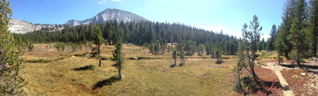
Leaving Bernice Lake cutoff we continued on the Lewis Creek trail entering a postcard worthy high alpine meadow. To our left a sheer precipice pulls the eye up to Vogelsang peak, now clearly in view. The trail here was well-trodden and its flat path cut a foot deep into the meadow sod. We crossed a low-flowing clear stream using some thin, half sunken logs. Our footsteps scared up a school of fingerling trout who darted up stream. The trail continues to head east through the meadow, steering one to a stand of hunched conifers covering a steep face of granite. With a quick left turn and we immediately beging ascending up the first of many steep switchbacks, the trunks of lodgepole pines tightly pressed and narrowing the trail. Looking back provided a great view of the alpine meadow we had just past through.

Looking up from the trail, Vogelsang pass lies behind the pine tree

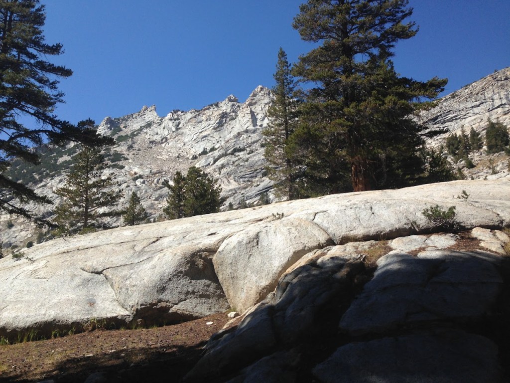
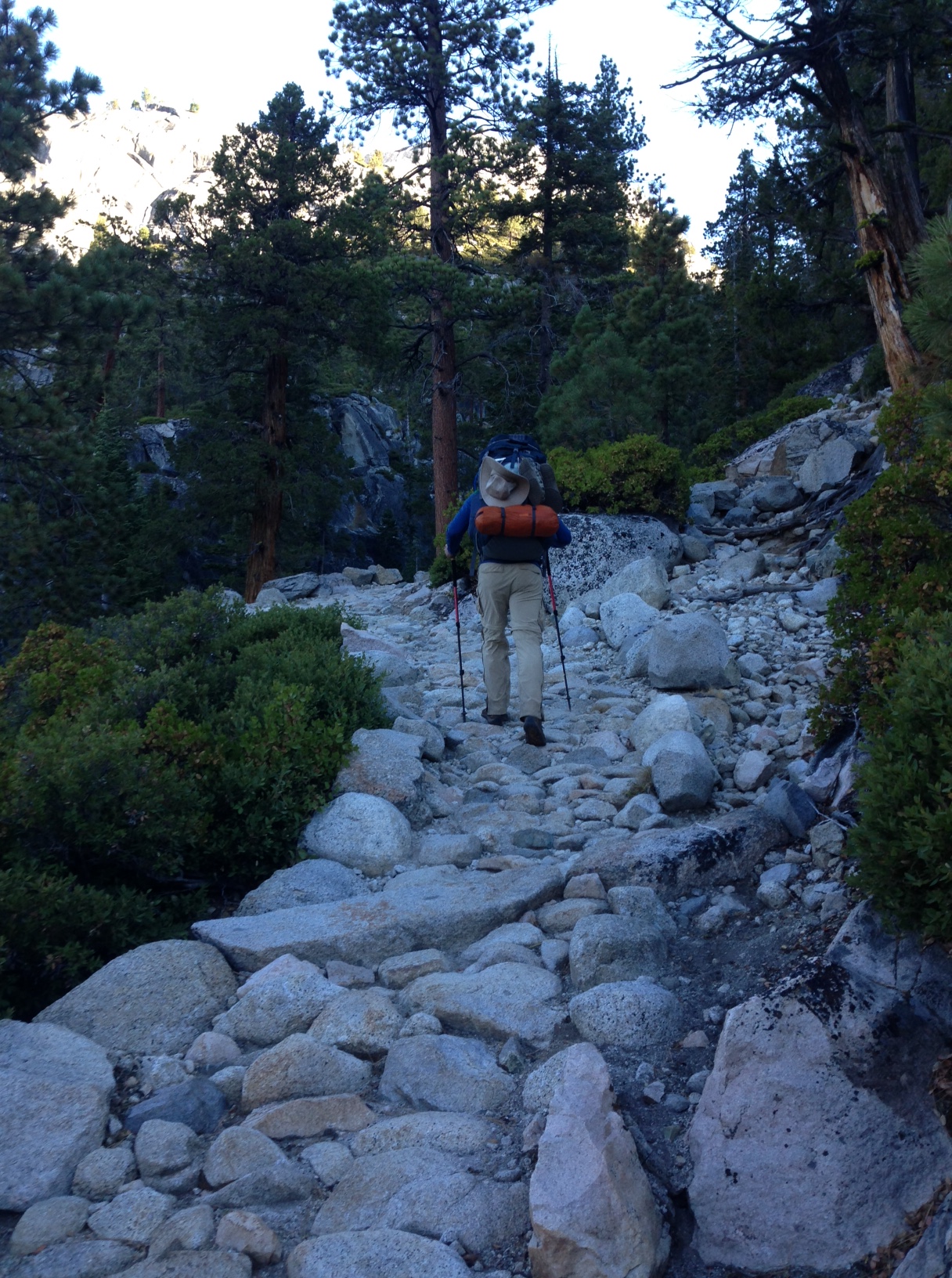
The extreme gradient of the rocky trail, quick turning switchbacks and the narrowness confine us to laborious work ahead to get to Vogelsang pass. The trail wound continuously upward, littered with loose scree, tree roots, that lent to our boots slipping back and uncertain footholds from which to push off. Using trek poles to stabilize balance, the slippery trail conditions proved to be a concentrated effort. Occasionally, we found ourselves stepping over periodic mossy seeps, water emanating from deep crevices. Taking turns in the lead, our crew pushed up the ascending path, taking periodic breaks to rest and take in the view. I found myself periodically looking up trying to determine our proximity to the apex of Vogelsang Pass. Fatigue from the day effort had drained us and I my energy level sapped.

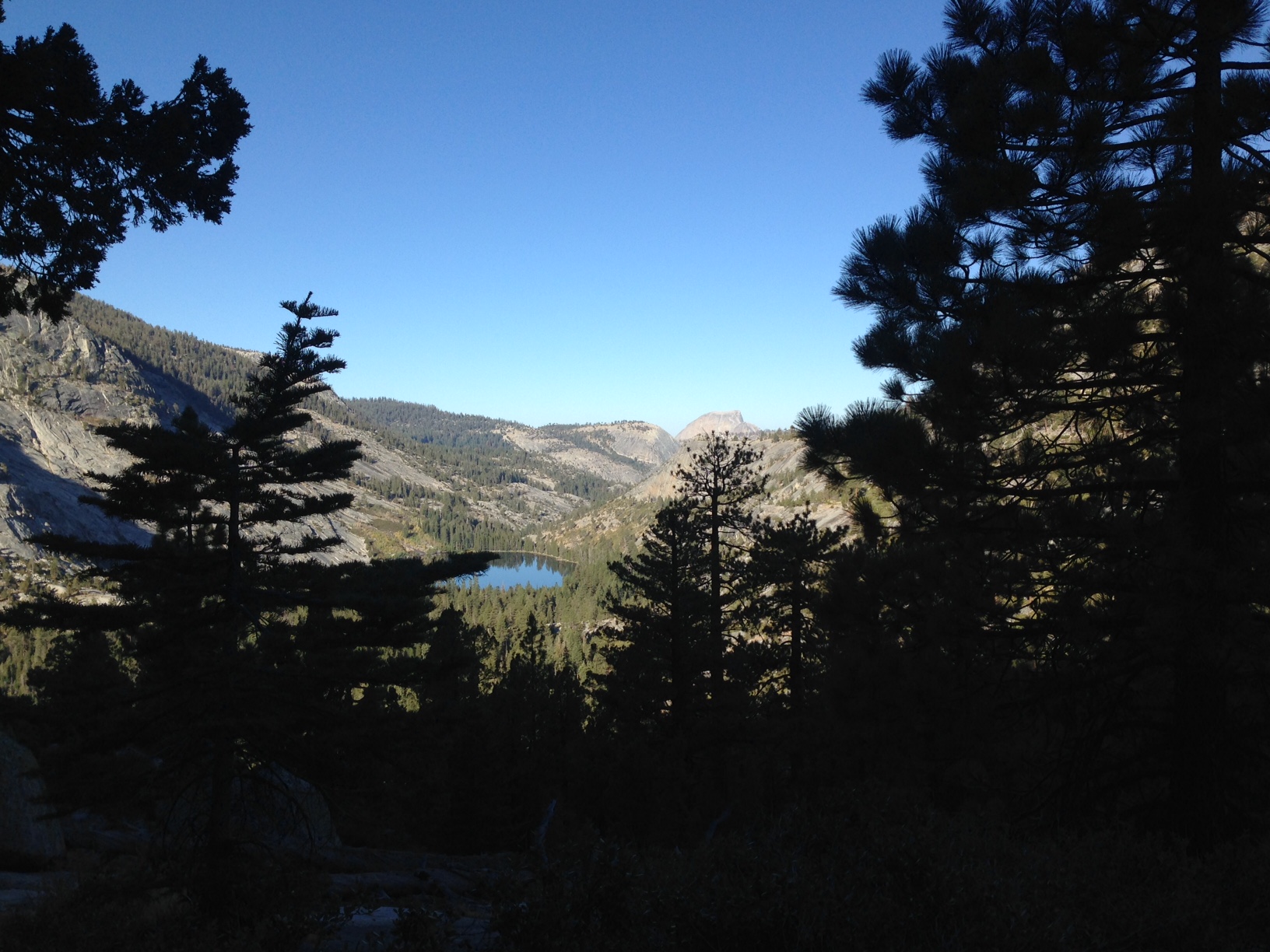
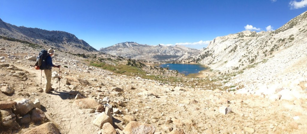
Emerging from the treeline, the trail flattened out to traverse westward along exposed, ledgy granite. It was here where a panoramic view south of both Gallison lake and Bernice Lake. Looking left, the Cathedral range in its magnificent starkness stood in desolate stillness. Distant towering peaks with remnants of snow stood on silent guard, daring one to venture into the tree-less & trail-less expanse beyond the range, and yet only four miles east, as the crow flies, and behind the imposing stances of Parsons peak and Simmons Peak, lay the John Muir trail.

img_5619
Will & Jeff at apex of Vogelsang Pass
img_5618
Kevin and Jeff taking in the view looking south from the Vogelsang pass trail out at Bernice lake
img_5622
At Vogelsang Pass,  heading north the trail meanders through a boulder field before descending down in the Vogelsang lakes area.

In hiking, its always the big payoff that keeps you coming back. The hard efforts to climb to a point where the views simply reward you with gratification and accomplishment is what its about. We lingered here absorbing the spectacular scene before us. But Vogelsang Pass still called us. With photos taken for future memories, we squirmed into our backpacks and headed for the pass. In mere minutes, we topped Vogelsang Pass. Disappointingly, no metal signage with the pass name or altitude welcomed us, and we weren’t sure we had crested the pass. Vogelsang pass routes through a bouldery saddle, straddled on each side by rocky, exposed granite peaks. The trail is obvious and well-worn snaking through the pass in a northerly direction. Soon, we were looking down on the Vogelsang Lake expanse and Rafferty peak looming in the distant north.

Looking down on the Vogelsang Lake expanse and Rafferty peak looming in the distant north.

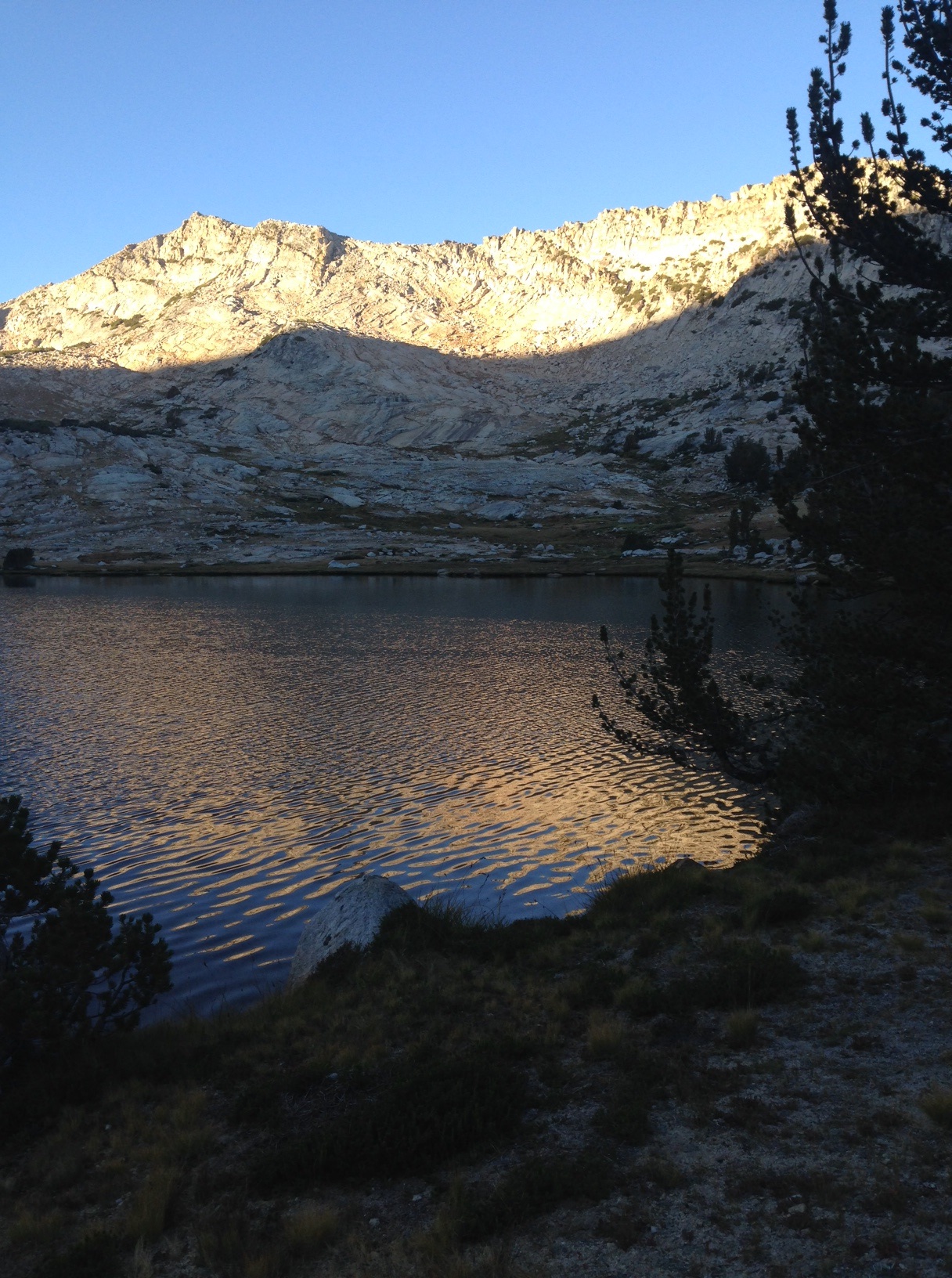
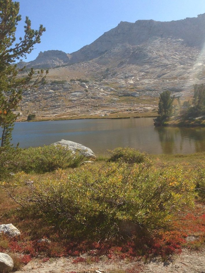
It was now mid-afternoon and the September sun was low in the west. Shadows from the western peaks elongated down the prominences and slopes toward the trail. The trail traverses on a moderate downslope with Vogelsang peak to our right aiming us to the west shore of the Lake. The easy slope of the trail toward Vogelsang Lake allowed for the occasional glances up to view the landscape and measure our distance. We eyed the shore line for a good campsite lakeside and we pointed out a few spots to each other. Upon arriving, we dropped our packs and walked a short distance along the northern shore locating a nice, flat area to camp. Once again, Kevin and I eyed the still waters and the rising trout and quickly set up our tents. Soon we had lines in the water but the bites were few – the fish Gods were not kind to us this night. Once back to camp we settled into our nightly routine. We took time watching the suns light, chased by dark shadows move up the eastern slopes toward the jagged pinnacles of the surrounding peaks. As dusk approach in earnest, a yellow alpenglow illuminated the rocky face and a steady, brisk breeze soon blew in from the west.

Austere Vogelsang Lake

As the sun set, I clamored up a granite knoll north of our campsite to look west at the setting sun. From this vantage point, the mountains were basked in the golden glow. To my surprise a commanding view of Half Dome and Clouds Rest lay before me, where days earlier we started our trek. I sensed a long time had passed, confirming the effect solitude and natural beauty has on those who spend days and nights out in nature.  

img_5635
Looking west from Vogelsang Lake, Half Dome & Clouds Rest could be seen.

The late September night was clear and we anticipated cold conditions at this altitude. Surprisingly, the wind continued to pick up to a gusty blow. My tent fly edges flapped noisily in the gusts so I weighted down the vestibules of my fly with small boulders, creating a seal to the ground, quieting the noise and preventing dust from blowing into the tent. This would be our last night in the Yosemite wilderness. Tomorrow would be our last day on the trail. Rafferty creek trail, it’s gorgeous meadows, and a nine mile hike to Tuolumne Meadows awaited us. My thoughts went my wife and kids and life. Perhaps it was the wind or my adaptation to days on the trail, but that night of sleep was the best I had on the trail.

Four Men & a Hike (Day 6) – Vogelsang Pass to Tuolumne Meadows.

img_5644
The morning light on Vogelsang peak.

Friday September 16 and our final day on the trail, the rising sun still blocked by the eastern peaks on the nearby lake. I was wakened by bright light filling my tent. I peered outside and though not visible yet, the rising sun cast a bright morning glow onto the prominence of Vogelsang peak. Last evening a gusty wind blew well into the early morning. Remnants of that wind, calmer now, rippled the waters of Vogelsang lake. It was an idyllic Yosemite back country morning and emersed in the quiet I sipped a cup of coffee in deep thought. Man, how I love it. Out here, I’m always drawn into contemplation, to thoughts of my parents, my family and my life. I think of my father, who as a young adult in the 1920’s, earned his eagle scout badge around Convict Lake in the southern Sierra’s in the 1920’s. I like to think he’s walking with me, hand on my shoulder, safely guiding me along the trail in some ethereal and spiritual way. My mother, on my other shoulder, who always was there to carry me through the tough days of life. Thoughts of next year and my youngest son getting married and future plans to backpack with him, and his siblings. I thought of my wife, who fully supports my outdoor obsession and my time away in the mountains. I have a lot to be thankful for and being in this beautiful country reminds me of those blessings.

Soon my mind jostled back to the task at hand and the regime of packing up camp gets underway. Our backpacks are lighter having eaten a good share of the weighty food and we sling them over our our shoulders, wiggled them into comfortable positions and with our usual “lets roll”, headed down the trail. Within a quick mile we came upon to the quiet Vogelsang High Sierra Camp, devoid of any activity. The camp had been disassembled and stowed for the winter but one could easily imagine the spring time hubbub at this beautiful spot, with its rushing creeks burgeoning with snow melt. Now, in the throes of an ongoing drought, the creeks were trickles and easy to cross. Vogelsang High Sierra Camp area is also the junction for several connecting trails and like spokes on a wheel, merged at this hub. To the east, trails head to Evelyn and Ireland Lakes and eventually Donohue Pass. To the Southwest, Booth, Emeric and Babcock Lakes and the junction to Merced Lake. Our own trail merges here and our travels will be taking us down Rafferty Canyon and our terminus at Toulumne Meadows.

Five days earlier we extricated John due to his ankle injury. You may recall we ended up laying over another night at Sunrise camp (we had planned on being at Merced Falls that night). That decision put us a day behind our original plans. To gain back that lost time we had to alter our final plans. Originally, we intended to hike southeast, past Evelyn Lake to a campsite in Lyell Canyon. On the way we would hike out and back to Ireland lake. The following day (what would have been today), we would have hiked out to Toulumne meadow to complete our trek. Instead, Vogelsang Lake became our last campsite and today’s hike cut off the original outward hike toward Ireland lake. It was unfortunate because I really wanted to explore that area.

img_5654
Signage indicating the many trails that converge at Vogelsang High Sierra Camp.
img_5652
Voglesang High Sierra Camp (disassembled for the winter)

Following the GPS maps on my cell phone we navigated and found the our new detour, Rafferty Creek trail. Since Rafferty Creek trail was not part of the original plan it was unknown to us. I knew it was a primary route up to Vogelsang out of Tuolumne. Rafferty Creek Trail not disappoint as it’s course along bone-dry Rafferty Creek was quite scenic with breath-taking distant views of the eastern spine of the Sierra. Coming out of Vogelsang HS camp, the trail descends at a fairly steep incline through a forest of lodgepole pines and typical boulder-laden landscape. To our left, unseen Boothe lake lays nestled in the lowland beneath an unnamed peak. The trail advances through Tuolumne Pass on its northerly descent, eventually flattening out along the dry creek. The well-traveled trail was cut deep into the land and we followed a trajectory across a breadth of land carpeted with red splotched heather-filled meadows and sporadically erratics (glacier deposited boulders). Rising in the distance the eastern most part of Yosemite National Park was Mt Dana, clear and majestic against the robin egg blue sky.

img_5663
Splotches of red color heather blanketed the meadows of Rafferty Canyon
img_5659
The epic eastern view of Mt. Dana heading down Rafferty Creek Canyon trail
img_5661
Brother time on the trail

Our pace was steady, not particularly difficult and I was soon lost in the usual backpacker’s rhythm of step and pole placement and the repetitious, sounds of my breathing. As we closed in on the John Muir Trail and Lyell Canyon we started to see more people coming up the trail, day hikers and backpackers alike, asking for trail intelligence and information. At times, I walked ahead of my friends, intentionally giving the two brothers some time to converse along the trail and enjoy some trail solitude myself. As we skirted along Rafferty creek we descended steeply through switch-backs and rocky steps in a forested area. Without looking at our maps, we sensed that the John Muir Junction was near and this proved correct as the headlong trail steeply dropped to then level off and intersect with the famous John Muir Trail. To the left on the John Muir Trail, a footbridge crossed the bleached river rocks Rafferty creek. With several miles left to Toulumne Meadows, we stopped to gobble down our last meal on the trail. As we ate lunch, hikers passed, heading down Lyell Canyon and points beyond. Some stopped to query us on our trek, while others with their first-day-on-trail enthusiasm blew by in energized conversation with themselves.

It was time to get moving and for the final time we donned our backpacks. With a relax pace and walking side by side on the wide trail we proceeded at a comfortable pace on the John Muir Trail. We talked about favorite parts of the hike, the effort put forth and the beauty of the area. I thought about how important it is to know you trail buddies. Everyone has their idiosyncrasies as do I and a level of acceptance and tolerance is important for a successful trip. Jeff and I have hiked together a long time and know each other well. Kevin fit right in as did John (who left earlier due to injury).

John and I had planned his trip for nearly a year and he had spent a lot of money for equipment and travel to come from Houston for this trek. I felt a pang of guilt he was not able to finish. But such is the vagaries of backpacking. Nature is in control and often reminds in unpredictable ways. After several miles we arrived at the pacific trail and veering left and heading toward Toulumne meadows lodge. This proved to be a wrong turn as we should have kept right continuing down the John Muir toward Lambert Dome and Glen Aulin Road where we parked the truck. This unwittingly added an additional mile to our hike! That last mile is always the longest. Jeff appropriately called it the aggravating mile to which we all laughed and agreed. After 6 days, we were ready for some good food and a long warm shower. That reality lay two hours away at my sisters house where she kindly allowed us to stay overnight. We arrived at the car, unloaded our well worn gear into the back, climbed into the car and headed back to civilization.

Unloading at the car after six days on the trail

Epilogue:  Many thanks to my wife Annette who puts up with me to taking a week out of each year to do these backpacking trips. I know the other guys feel the same way about their wives too. Each year gets a little harder on the body, but the mind remains optimistic and excited every time I head out. Many thanks to the “Medi-vac” Millers!  Celia (my sister) and Gary (brother-in-law) were instrumental in helping extract John H after his ankle sprain. Since they live in the Sierra foothills, their home has become a convenient stopping point for us on our trips. The Millers are always ready to provide a hot shower, a great meal, fine wine and a soft bed. If not for them, it’s a good chance that my trek would not have continued. I also need to thank my hiking friend Curt Cragg who lent me his Delorme (Garmin) Inreach for the trek and two bear canisters. I’ve learned a lot from Curt and his willingness to educate and share gear save me expense and time in hunting it down. Thanks to all who express their enjoyment at viewing my photos and stories of the trail. I really enjoy sharing them. In some way, I hope those who aren’t into backpacking or hiking, find my experiences and photos of interest and satisfy a curiosity about these beautiful areas. The Sierra never disappoints me and I am enjoying these experiences in the wilderness and discovering much about myself and these lands. Thanks for taking time to read my stories.