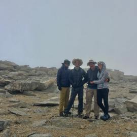
I awoke from a deep sleep to the brightening morning. I had one of my best nights of sleep that could recall having when on the trail. About the same time I heard Jeff opening the flap of his tent door. My thoughts wandered from wondering how John was faring, to my wife, and what lay ahead in our trek. I started collecting and organizing my gear inside my tent, wiggled into my hiking pants, socks, shirt & La Sportiva Approach shoes. Emerging from my tent, greeted my buddies. I fired up my camp stove and boiled water for coffee and one of my Mountain House meals. Todays breakfast would be freeze dried sausage and egg. Soon, we all were in the midst of breaking down camp and packing our backpacks.
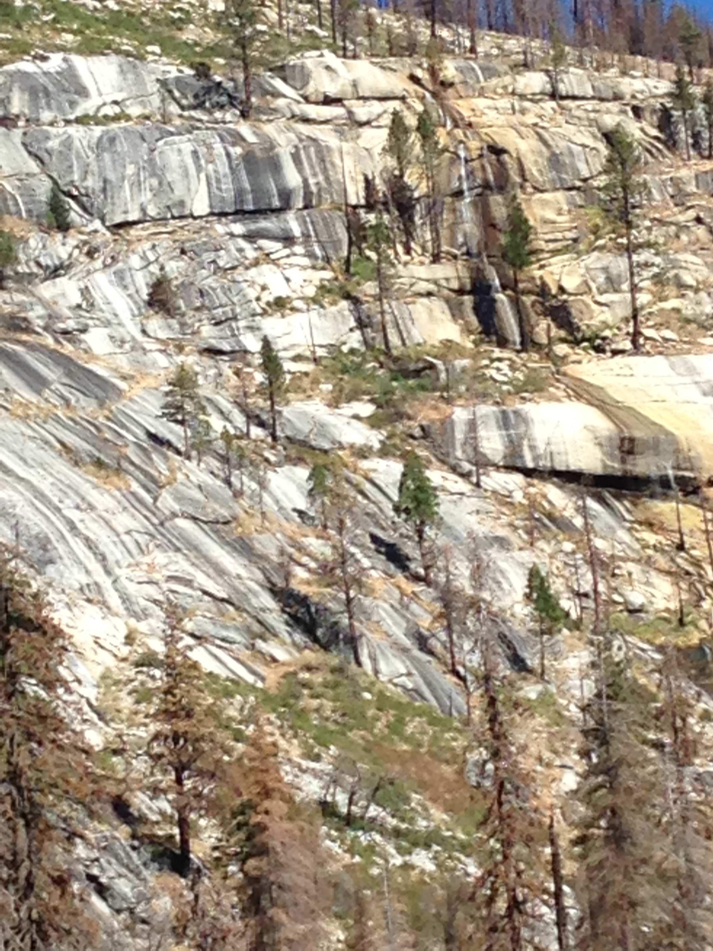
Bidding adieu to Merced falls, took our first steps of day four and headed up the trail continuing east toward Lost Valley. An epic day of hiking awaited us and we worked our way through the Merced watershed. A short day of relatively easy hiking lay ahead to reach Merced Lake. A slight climb out of Merced Falls on a north easterly tack skirts the base of an unnamed dome before you enter into Lost Valley. Lost Valley soon appeared and we pursued a steady trail through a forested area nestled amid the high granite walls of Bunnell Point to the south and the steep granite edifices east of Moraine Dome that framed the north side of the valley. The meadow fire had burned into Lost Valley, and a plethora of new growth covered the forest floor. From the valley floor, the walls ascends steeply, slowly rolling back, away from the distant hiker. The sparsely covered granite gives way to a pine covered apex, lipped edges and ground cover firmly rooted in cracks and crevices. We were treated to a cascading stream that fell from the lip of this ridge, its waters hitting outcroppings on the descent, splashing and deflecting down to the valley floor to eventually merge with the Merced River.
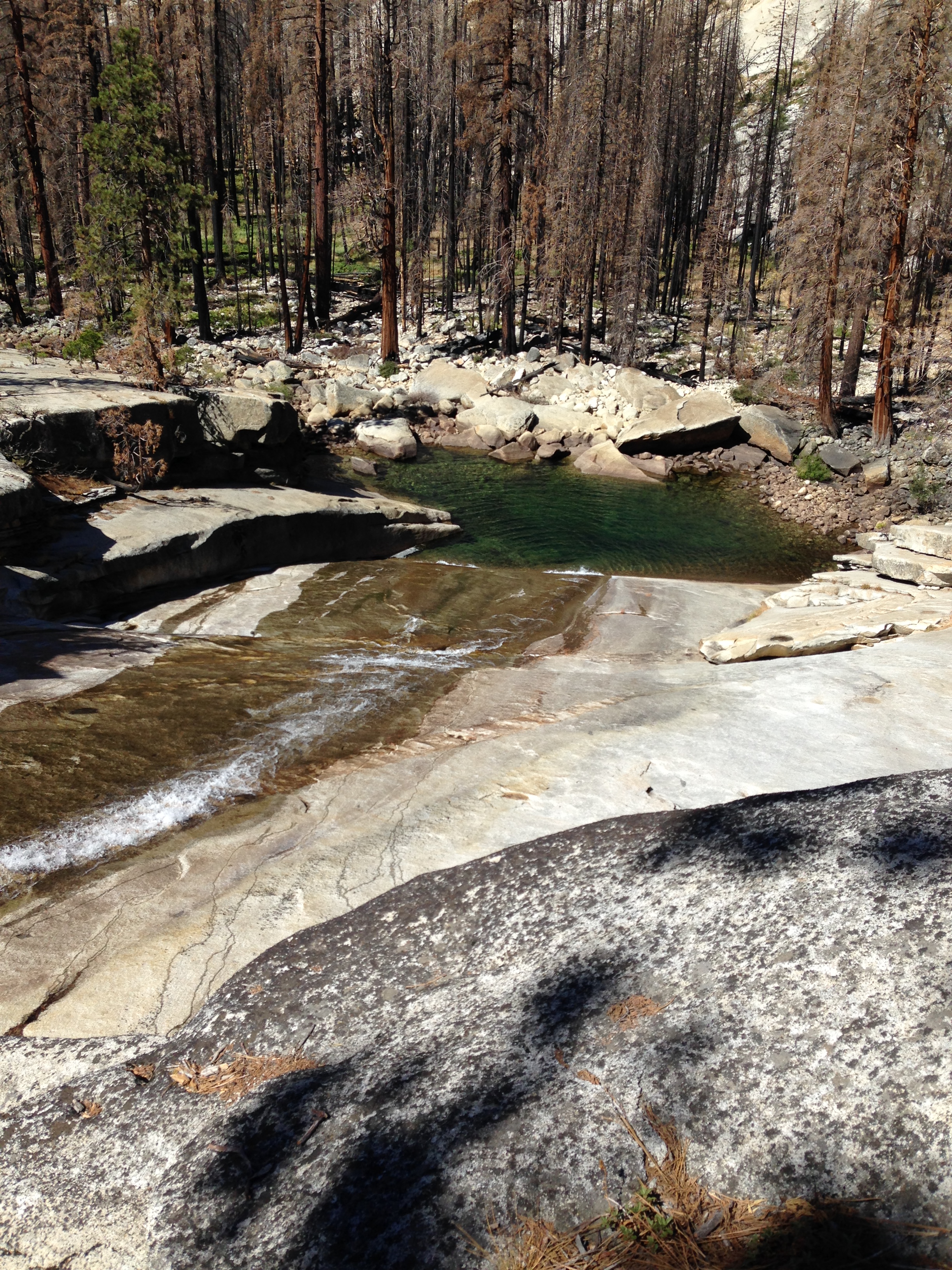
A mile into the hike we came upon Bunnell cascade. During the spring, this impressive gap forces the waters of the Merced into a narrow crevice dropping with force and determination to another beautiful emerald-colored pool. However, this late in the year, the cascade is tame and the flow of water a mere trickle. The steepness of the cascade can be measured by the climb one has to make to ascend along this bottleneck of granite. We stopped to explore around this area taking in the falling waters, the burnt forest and imposing walls of the surrounding granite.
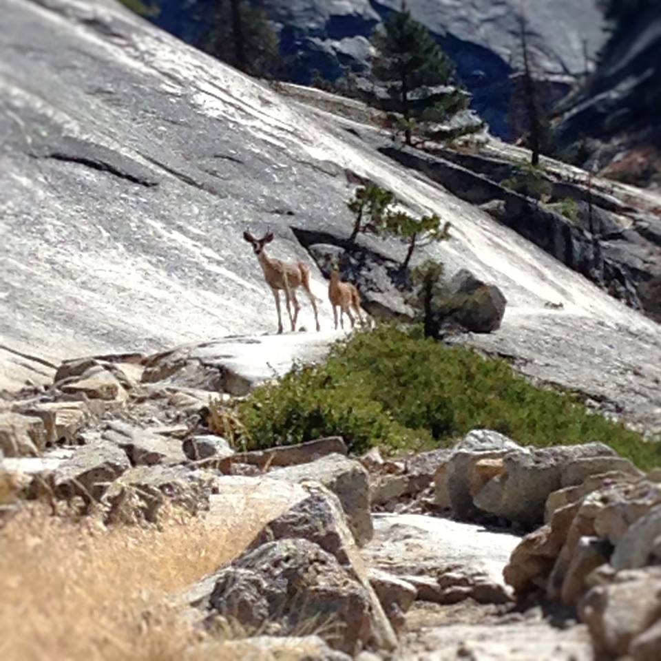
Onward we trudged now in an easterly direction, a slight uphill climb through the squeeze of the Bunnell Cascade gap. Coming down the trail, we met a family of deer approaching cautiously. A young buck was in the lead followed by a doe and her fawn. We stopped, silently taking in graceful friends. The animals stopped as well, stoically measuring us for threat and danger. The deer continued toward us, now with confidence in their walk. It appeared they aim to pass right by us on the trail, but within a few yards of our position the buck turns left leaving the trail tacking across the granite slope. As they circumnavigate our position, we were thrilled to witness, quiet observers in nature’s theater.
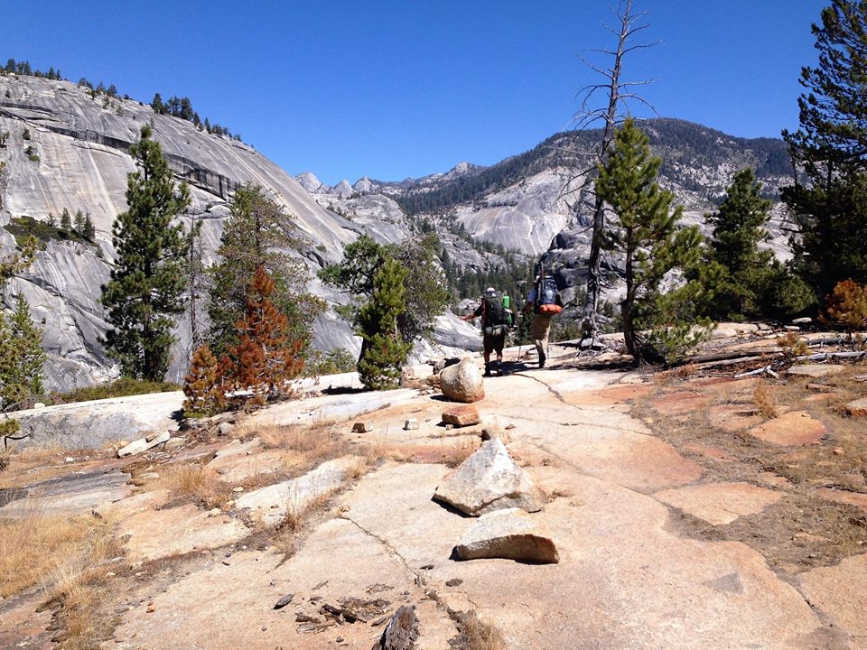
The gradual climb out of the cascade continued for a half a mile interspersed with small meadows and granite escarpments. When hiking a new trail, each turn is a new treat. We know the hidden gems we discover today in mid summer will appear different in winter or spring. It’s this ever-changing dynamic of weather and conditions in Yosemite that acts as a lure for backpackers to come back to see it in a different light. We soon crossed a footbridge that leads us to the south side of the river and turning east again, we launched into an 800′ climb over the next mile. A series of challenging switchbacks pulls you evermore upward and eastward. On these southern cliffs that navigate over impassable areas of the Merced river, we are treated to deepening views into the narrow gorge through which the Merced river crashed. The trail becomes a combination of purposely placed cobbles and with granite steps, periodically place to elevate the natural inclination of rocky slope. Tired legs, labor over these pesky steps, to burning thigh muscles and deep exhalations from tired lungs. These cobbled trails were clearly designed with pack trains in mind, and we witness a mule train on its return trip from Merced lake navigating down the trail, leaving fresh, odorous evidence of their passage. The hike reaches its apex as the tread flattened out and we hiked across open areas of granite that tendered us vistas of the canyon we just navigated through. Looking back, the views to Merced Falls & little Yosemite Valley – Looking ahead – the distant views of high peaks and promises of further climbs.

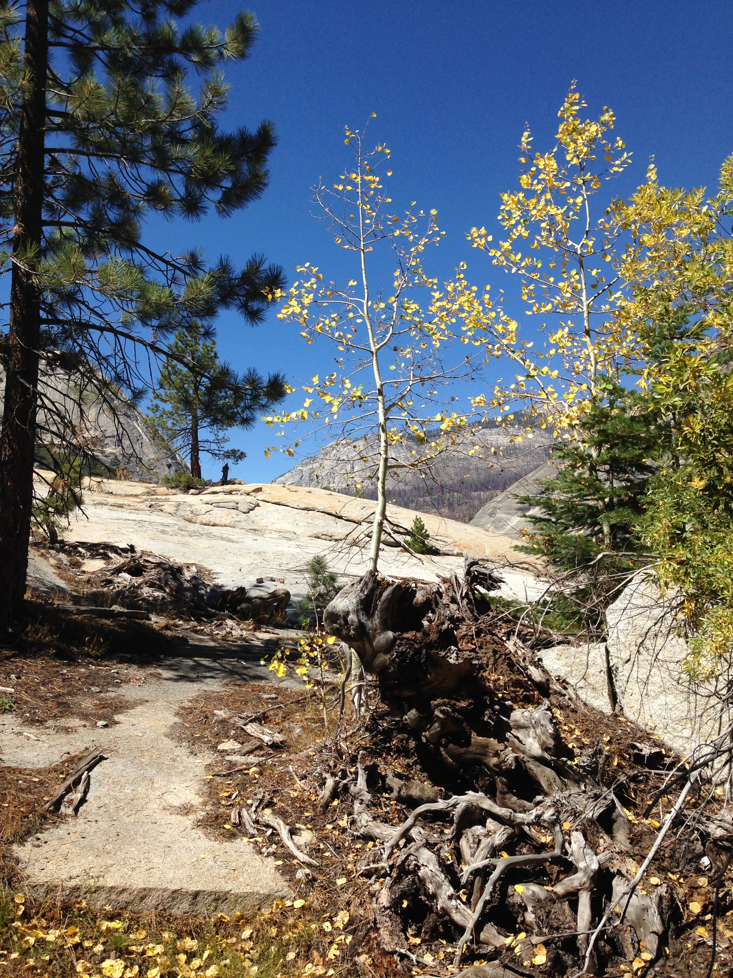
Where the cobbles end, the trail tops out, meandering across smooth granite lined with small boulders to mark the trail. We came across early evidence of fall in a small grove of yellowing aspens whose quaking leaves were dropping upon the trail. Now descending, we again met up with the Merced River and transited another footbridge that carried us to the north shore of the Merced and the trail into Echo Valley. Echo Valley is flat and dry and the confluence of two creeks. Miles to the north, Echo Creeks journey began near the Cathedral range flowing south and spilling over the south-facing cliffs into the Merced watershed to merge with the Merced River. Conversely, miles to the south Clark Canyon Creek is born in the steep reaches of Mount Clark and Quartzite Peak, Flowing north and descending over the north facing cliffs above Echo Valley to Merge with the Merced. Appearing on maps to be wide and vigorous creeks, both were bone-dry, a testament to the continuous drought and late summer conditions in California. Fortunately, our water supply was adequate and we were not relying on Echo Creek to replenish.
Echo Valley also offers substantial tree shade and a needed respite from the days building heat in the bottom of this canyon. We opted to take advantage of the shade in this valley and stop for a lunch. I dug through my bear canister pulling out a foil pouch of Tuna fish, a tortilla, some cheese sticks and crackers and washing it down with water. We eat, discussing the dry conditions of the creeks and the steep ascent of the nearby Echo Valley trail head. The trail Junction, steeply heading north, directs adventurous hikers out of Echo Valley and north toward Cathedral peak area or if desired, to rejoin the John Muir Trail. After our rest, we gear up and once again are heading on our easterly route toward Merced Lake. The trail here is obvious and well worn and we find ourselves hiking through sandy scree indicative of low-lying river basin sand and its proximity to the merging rivers and creeks.
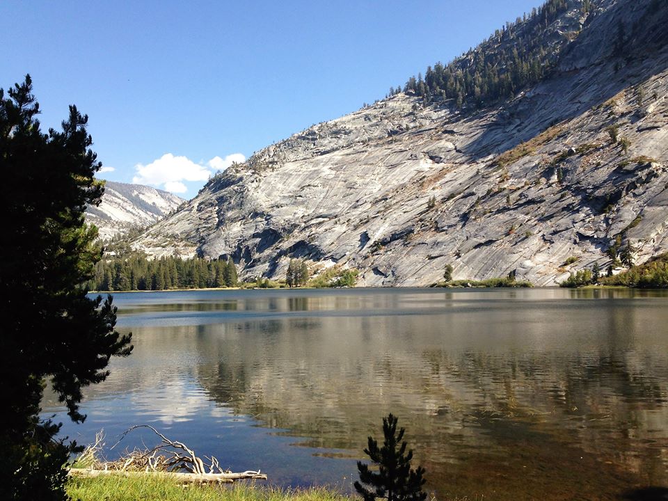
We were now within a mile of Merced Lake and the trail continues with its flat tread eastward, with slight curves around the contours of the nearby granite walls. Soon, we are getting glimpses of the welcomed site of Merced Lake and the Merced river head waters. Arriving at the lake source of the Yosemite’s Merced river was inspiring. The Merced River; the iconic river of the Yosemite Valley, whose waters rush over both Nevada and Vernal Falls and meander through the grand valley itself is fed from the collected waters of Merced lake. Above the lake, the Merced river courses down from Washburn Lake and the Triple Peak Divide area. Waters in the Merced build in volume from emerging springs and gushing tributaries emanating from Red Peak fork, Triple Peaks fork and the Merced Fork. The Merced pours into picturesque Washburn lake first, spilling out and flowing onward to gorgeous Merced Lake. As the Merced cascades through these lakes and canyons, it nourishes along its shores wetlands lined with reeds, flowers and shrub and trees. Over the millennia, the river has carved artistic sculptures into the granite walls and boulders bringing forth its hidden beauty and grandeur. Its heady stuff to stand in awe of as surely others have done over time, to revel in the mysterious past, the hidden stories that the Merced River contributes to the whole of the Yosemite National Park.
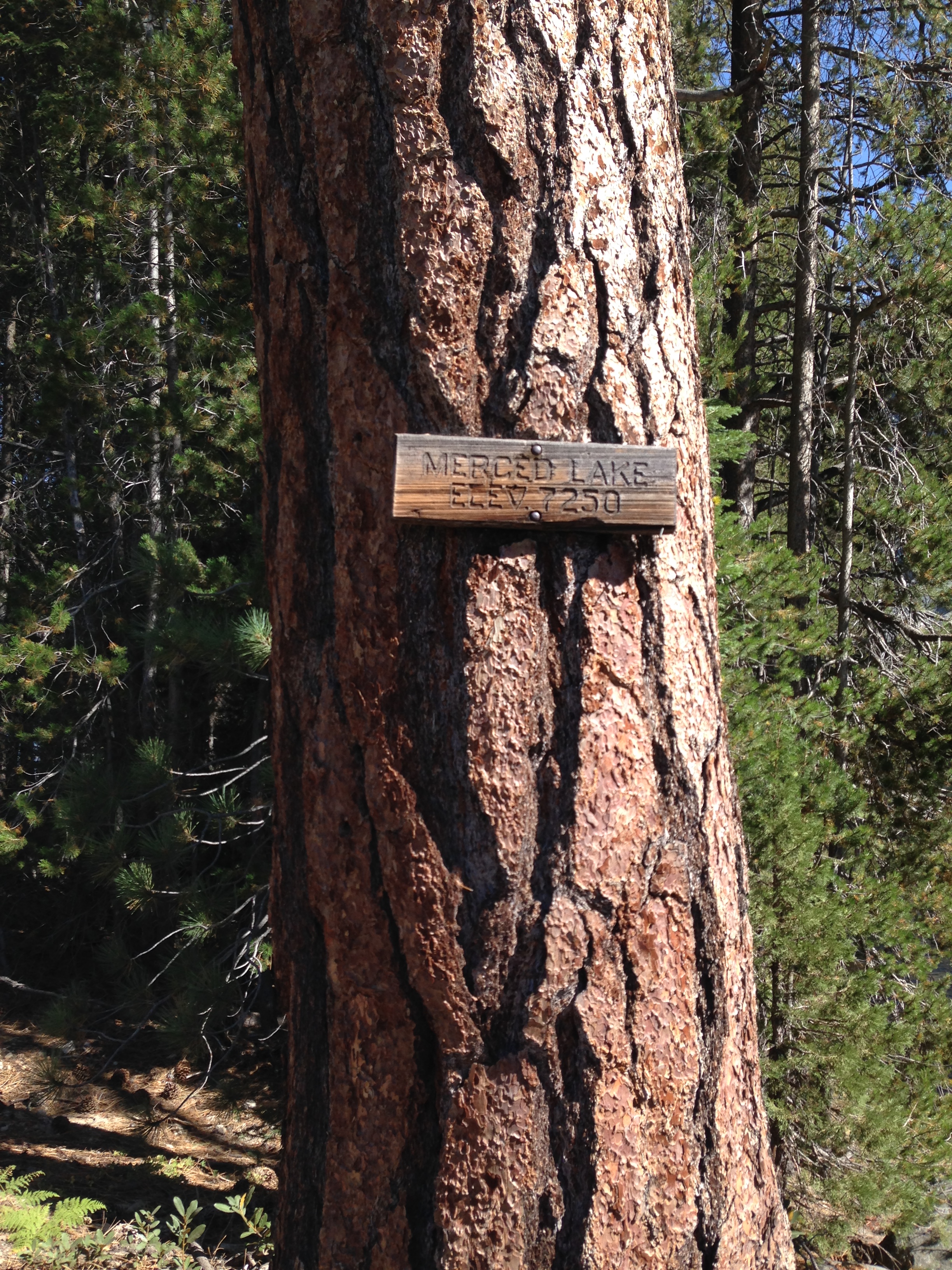
We continued the final mile toward camp along the north shore of Lake Merced. A tree marker indicated the lake elevation to be 7250′. Over the course of the 6 miles we hiked today from Merced Falls, we had gained about 1000′ feet in elevation. None of us felt particularly exhausted and Kevin and I were eyeing shoreline access points revealing to us access points to the lake and fishing. Camp Merced is a “surprise” of a camp. There is a High Sierra Camp here at Merced Lake, one of five in the Yosemite park. The camp is lined with canvas covered yurts active with human activity. Outside the boundaries of the High Sierra Camp are well maintained and spacious camp areas for backpackers. A looming, redwood tree towers above a spigot capped with a drinking fountain. Running water can be gathered to utilize for cooking a nice respite from using our gravity flow water filters. Nearby there’s restroom with a flushing toilet. Three days into the hike, it felt a little like cheating to use these amenities.
We found a great campsite and erected our tents and soon headed down to the lake shore to beckon the fishing Gods for some trout action. Venturing back along the trail, I find a spot that allows me to navigate through lodge pole pines to a small beach on the shore of Lake Merced. Several casts into the clear waters yielded no action at all. I threw the line out near some visible underwater reeds and immediately felt the hit of a strong bite. Tip up and reeling vigorously, I brought in my first small brown trout. After releasing him I cast again into the same area – again I was rewarded with an even stronger bite and reeled in another beauty of a fish. This brownie was gorgeous, yellow in hue with dark speckles and spots and every bit of 10 inches in length. I gently unhooked him and released him back to the waters, overjoyed with the fight and effort he gave. The view across the lake is compelling, with towering precipices and majestic trees all the while fishing in quiet solitude. Several more strikes occur, the fish diving for sunken logs and myself reeling the line to thwart its plan. My evening is fulfilled, I reel in my last cast, gather my tackle box and regress back to camp with satisfied dreams of Sierra fishing.

Back at camp and nestled amongst the surrounding lodgepole, ponderosa, incense cedar, and white fir, darkness came quickly. We collected some deadfall, stacking the for a nice fire. Over our camps stoves we lounged in our portable camp chairs, talking in low voices as the camp quieted down. Sparkling stars dotted the clear night sky and a waxing moon shone bright through the tree tops out here in the deep recesses of Yosemite. Our musings soon led to tomorrow’s hike. It would be nearly 9 miles, with two big climbs and a continuous uphill gradient for nearly 8 miles. We agreed we should start picking an early 7:00am “on trail” time. Tomorrows goal was Vogelsang Pass. Situated at 10700′, we would gain 3500′ in elevation. At backpackers midnight we all went to our tents and retired for the evening anticipating the next days effort.
